
Wet weather moving in is here to stay
MACON, Georgia. (41NBC/WMGT) – Today will be our last day of completely dry weather for a bit as unsettled weather moves into Middle Georgia.
TONIGHT.
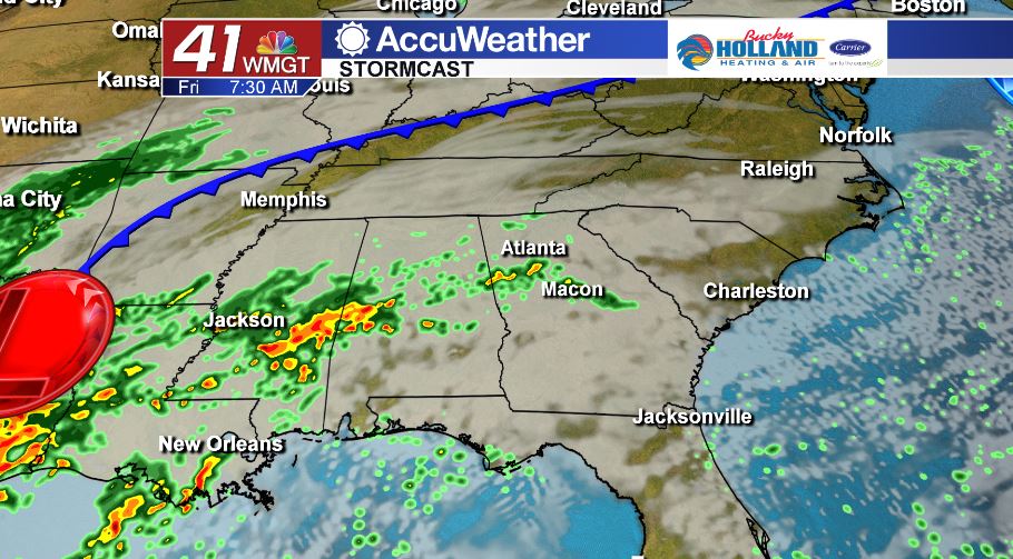
For the rest of your Thursday, more clouds will begin to roll into the region leading to a mostly cloudy sky overnight. Cloudy conditions will keep temperatures up compared to this morning. Overnight lows will bottom out in the upper 50’s and low to mid 60’s. Isolated light showers will be around for the Friday morning commute.
TOMORROW AND WEEKEND.
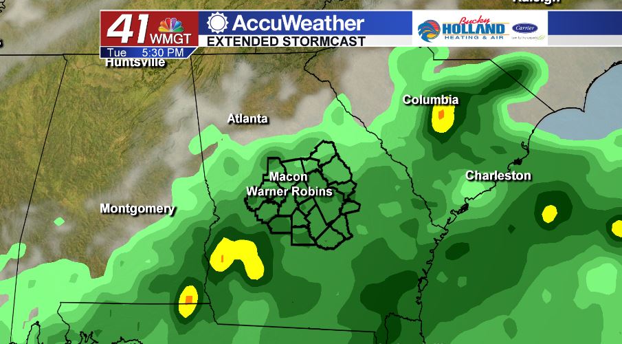
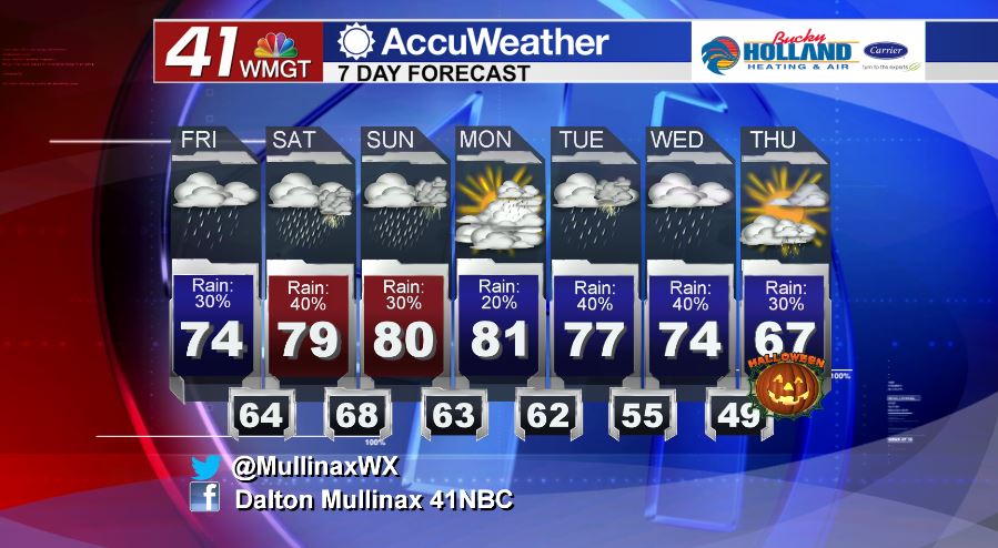
Friday night football will be wet at times as isolated showers are forecast. Tomorrow afternoon, temperatures will top out in the middle 70’s under a mostly cloudy sky. Showers will be hit or miss throughout the afternoon and evening. Temperatures tomorrow evening are going to bottom out in the middle 60’s. The unsettled weather continues into the weekend. On Saturday we will be dealing with scattered showers and a few thunderstorms. Severe weather is not in the forecast at this time. A cold front will move through during the day on Sunday leading to temporary clearing as we head into Monday.
NEXT WEEK.
Monday will be greeted with isolated showers, but rain chances will be on the rise as we head towards the middle of the week. Temperatures will be running above average during this period.
Follow Meteorologist Dalton Mullinax on Facebook (Dalton Mullinax 41NBC) and Twitter (@MullinaxWX) for weather updates throughout the day. You can also watch his forecasts Monday through Friday on 41NBC News at Daybreak (6-7 a.m.) and 41Today (11 a.m.)


Leave a Reply