


Wet end to the first work week of 2020
MACON, Georgia. (41NBC/WMGT) – A partly to mostly cloudy sky will yield a few showers today before widespread showers and a few storms move in tomorrow.
TODAY.
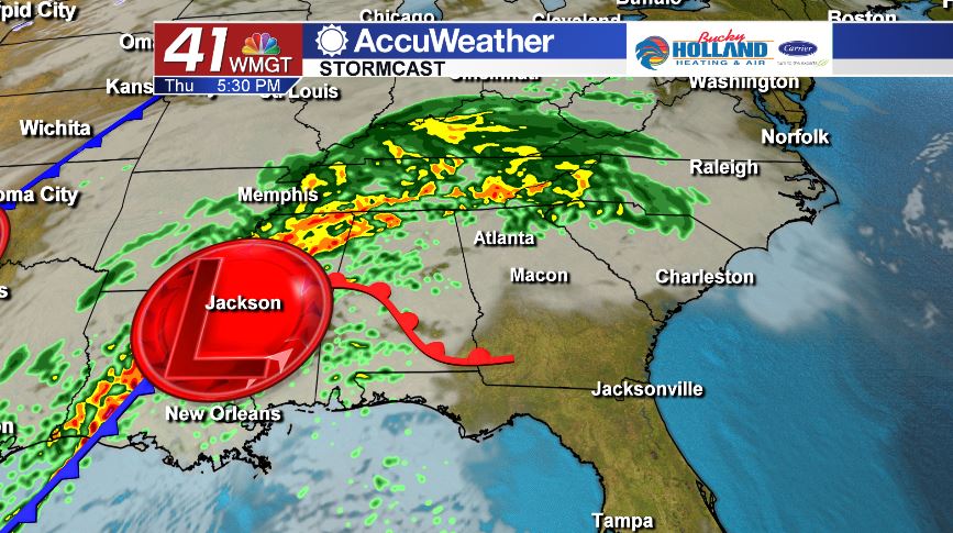
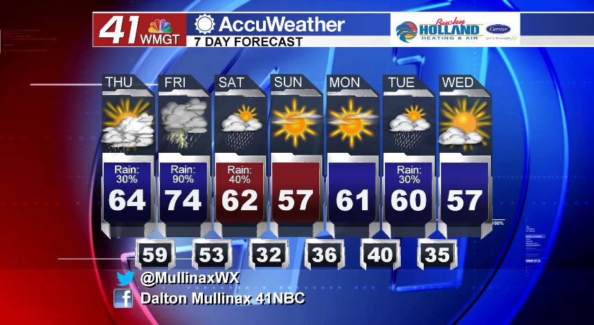
Temperatures will continue to run above average (57°) as we head into this afternoon. High temperatures will top out in the low to middle 60’s across the area under a partly to mostly cloudy sky. Rain showers will be few and far between today, with only a few light and isolated showers expected. Tonight, temperatures will be on the warm side. A warm front will lift through the area sending warmer temperatures our way. We will be in the middle to upper 50’s tonight with increasing cloud cover and rain coverage as well.
TOMORROW.
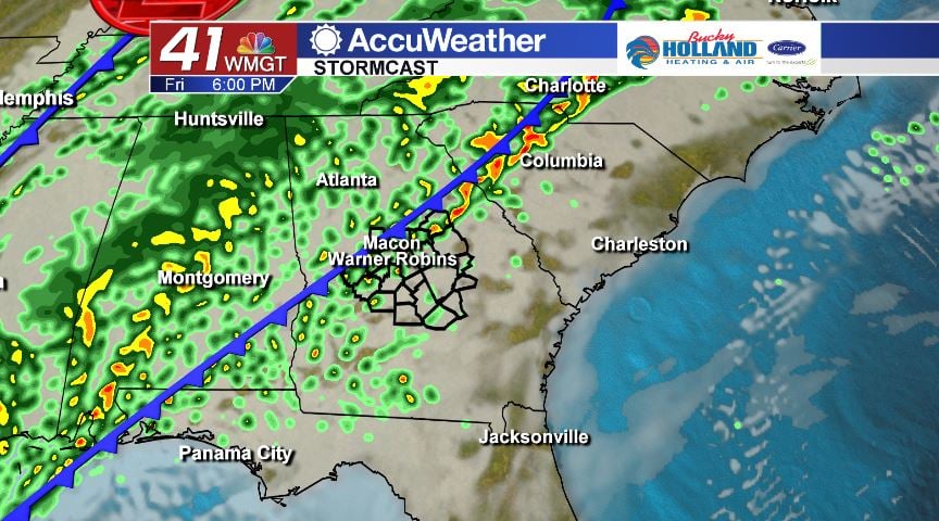
A cold front is going to move through the area, bringing us the chance for widespread showers and a few thunderstorms. As of 5 am on Thursday, January 2, the Storm Prediction Center has parts of Middle Georgia included in a Marginal (level 1/5) risk area. The main storm risk area will stay well off to our southwest, but we could see an isolated strong storm or two with heavy rain and damaging wind gusts being the main storm threats. Temperatures will be on the warm side tomorrow afternoon in the middle 70’s.
WEEKEND AND BEYOND.
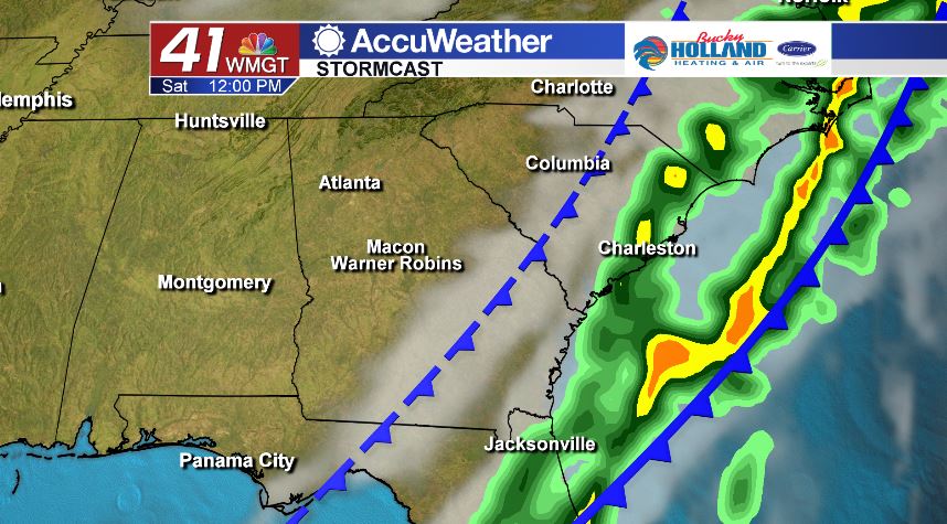
A few showers will linger around on Saturday morning, but as we head into the afternoon hours we will begin to clear out and return to more seasonal temperatures. Sunday is completely dry with temperatures during the afternoon hours rebounding into the middle 50’s after starting the day off in the lower 30’s.
Follow Meteorologist Dalton Mullinax on Facebook (Dalton Mullinax 41NBC) and Twitter (@MullinaxWX) for weather updates throughout the day. You can also watch his forecasts Monday through Friday on 41NBC News at Daybreak (6-7 a.m.) and 41Today (11 a.m.)

Leave a Reply