Wet and cool holiday weekend
MACON, Georgia (41NBC/WMGT) – A shortwave digging across the Great Lakes region, that’s embedded within the broad trough at the mid-levels is working to nudge surface high pressure 


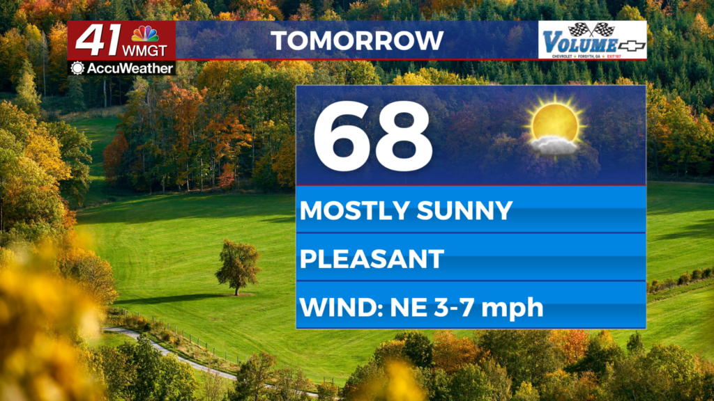
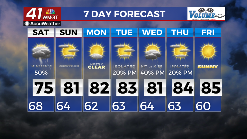
 offshore over the next day or so. Models suggest the high will be replaced by yet another high pressure system expanding into the Mid-Atlantic, setting the stage for some wedging over the next few days. With a swath of moisture traversing the northwesterly flow to our west and streaming into the Deep South, as our unseasonably dry airmass has begun to erode. Chances for isolated to scattered showers and perhaps some isolated embedded thunderstorms will return to round off the week. Chances will be highest along our far southern tier, in closest proximity to a stalled frontal boundary draped across the Florida panhandle/northern Gulf. Temperatures topping out in the 80s and trending slightly cooler in areas with higher chances for showers and thunderstorms. Lows will drop into the upper 50s to upper 60s with more cloud cover overnight. Moisture will continue to build in through Saturday, so expect rain chances to expand northward, increasing in coverage. Modest instability looks to be present to kick off the weekend, so we may see more thunderstorms thrown into the mix. Due to the thicker cloud cover expected with more numerous convection, highs on Saturday will be several degrees cooler areawide than today in the mid-70s to mid-80s.