


Weekend looking warmer with some rain chances
Good Evening!
It is time for the weekend and we have got a mix of good and bad news…so let’s start with the good!
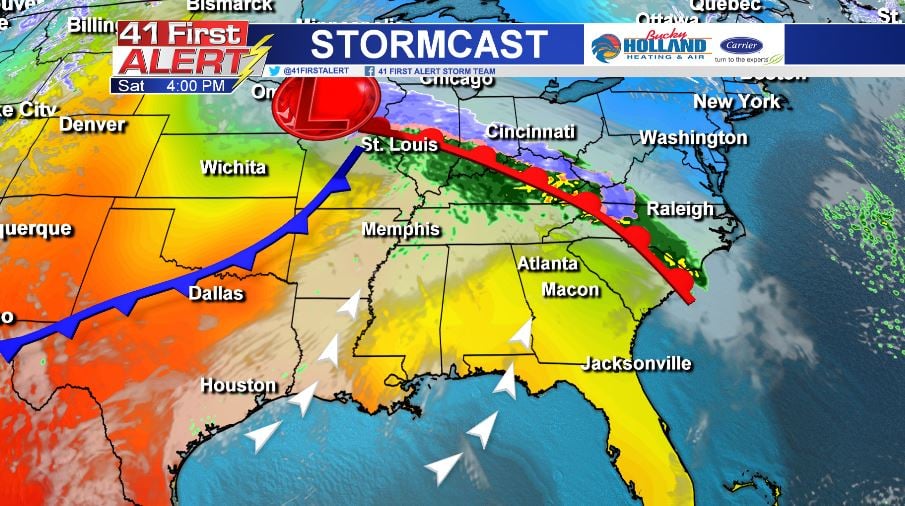
Saturday:
Warm air moves in quickly under a warm front with our highs back in the 70’s! We will see a few clouds moving in throughout the day, but overall a great day to get out and enjoy the Cherry Blossom Festival! We could see a few isolated showers during the evening, but hopefully nothing to really dampen the street party.
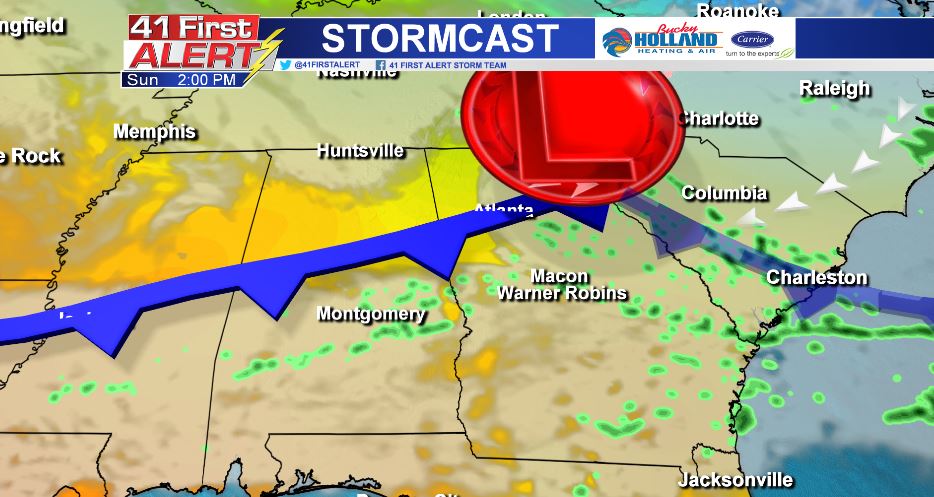
 Sunday:
A very different weather pattern sets up on Sunday as the area will see scattered showers with a small chance for a few rumbles of thunder. What’s more, we have 2 cold fronts headed our way by Sunday afternoon/evening! The cool down will begin Sunday night and move into Monday.
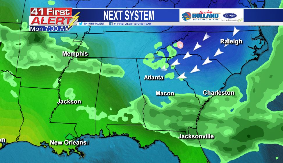
 Monday:
A “wedge front” (when cold air gets trapped by the Appalachian Mountains) moves into the area and brings cold air to pretty much all of North Georgia and some parts of Middle GA. Winter is not quite done with us yet as our highs will struggle to make it into the 50’s. The good news here is that the wedge only hangs around into part of Tuesday before we see yet another warm up!
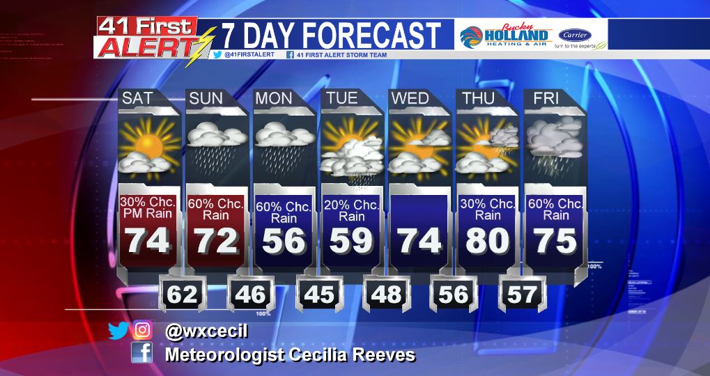
Through the next 7 days we are all over the place on the temperature roller coaster as we head back to the 80’s and 70’s before yet another storm system!
Have a great weekend and stay safe!
Chief Meteorologist Cecilia Reeves
Leave a Reply