


Warmer temperatures on the way over next several days
MACON, Georgia. (41NBC/WMGT)- Warmer weather is on the way beginning this afternoon as highs climb back into the middle 60’s.
TODAY.
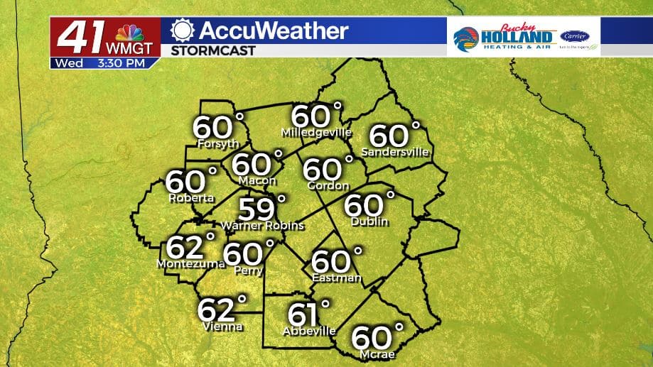
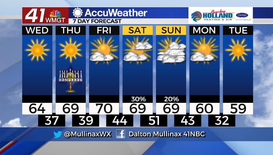
The sun will be out in full force again this afternoon as high pressure builds in from the southwest. High temperatures will climb into the middle 60’s before falling back into the upper 30’s overnight. A clear sky this evening will allow temperatures to fall quickly.
REST OF WORK WEEK.
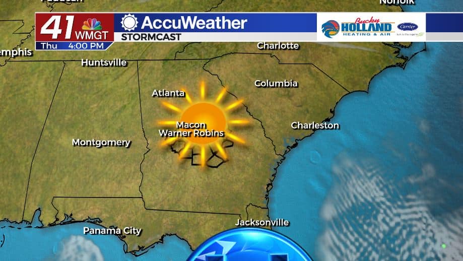
We stay sunny and dry through the end of the work week. Afternoon highs will top out in the upper 60’s and lower 70’s. Overnight lows will range from the upper 30’s to middle 40’s.
WEEKEND & BEYOND.
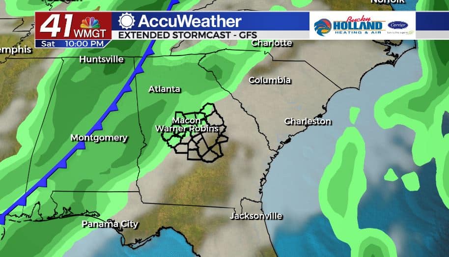
An approaching cold front will bring showers to the area beginning Saturday afternoon. Through Sunday morning long range models are in pretty good consensus, but past that the models diverge. The American model (GFS) kicks this system out by Sunday afternoon. The European model is slower to move this system out and keeps rain, heavy at times, around through early next week. This is a forecast that needs to be watched in the coming days.
Follow Meteorologist Dalton Mullinax on Facebook (Dalton Mullinax 41NBC) and Twitter (@MullinaxWX) for weather updates throughout the day. You can also watch his forecasts Monday through Friday on 41NBC News at Daybreak (6-7 a.m.) and 41Today (11 a.m.).

Leave a Reply