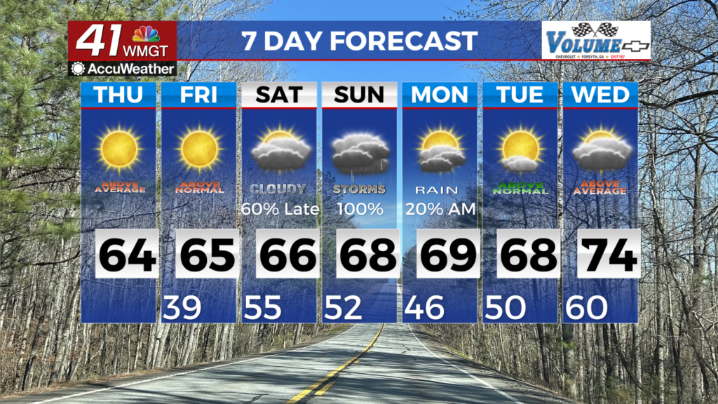
Warmer temperatures lead to increased rain chances late Wednesday
MACON, Georgia (41NBC/WMGT) – Surface high pressure slides to the east. High temperatures will rise into the 70s. Tonight will be cool and crisp again with temperatures in the 40s. A weak cold front will bring a line of showers into northwest Georgia late Wednesday into early Thursday, quickly pushing east of the area by Thursday afternoon. Behind the front, cool, breezy northwesterly flow returns temperatures to below seasonal average by Thursday afternoon. Highs return into the 50s to low 60s across north and Middle Georgia, with 40s possible in higher elevations. A gradual warming is expected, with highs in the low to mid 70s by Saturday. The main concern through the forecast period will be dangerous fire weather conditions. Wednesday’s relative humidity values will drop into the 20s across most of the area. Although rain returns, Thursday’s quick shot of precipitation will not be enough to wet fuels. Gusty winds and dry conditions that follow the rain may be enough for Red Flag conditions.