


Warm Wednesday ahead of a rainy Christmas Eve
We have had a few nice days here in Middle Georgia with sunshine returning to the area and highs warming to the 60’s.
We have one more nice warm day on the way for Wednesday, but clouds will be on the increase.
Highs tomorrow will once again warm to the 60’s, but it probably won’t be quite as warm today because of increasing cloud cover.
Overnight tomorrow we will be watching as a line of rain and storms moves across the southeast, eventually moving into Middle Georgia Christmas Eve Day.
Currently it looks like this line will be moving in Thursday morning and finally passing out of the area by the early evening.
 ”
”
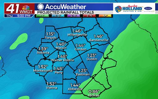
The main threat with these storms will be heavy rain.
Rain totals 1-2″ will be possible across Middle Georgia in a short period of time, so if you will be on the roads, be ready for the potential of some localized flooding.
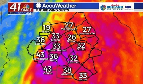
Not only will we see heavy rain, but gusty winds will be likely.
Wind gusts 35-45 mph will be possible through the afternoon on Thursday.
A few thunderstorms could bring stronger wind gusts as well.
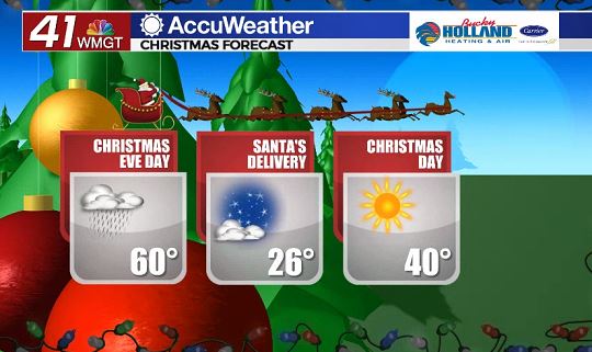
Behind the rain and cold front we will see a HUGE drop in temperatures.
Lows will drop to the 20’s overnight and on Christmas Day we will only warm up into the upper 30’s and low 40’s.
But hey, at least it will be sunny…
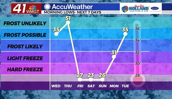
Chilly weather will be sticking around through the weekend with a slow warm up by Sunday.
The good news is that we won’t be seeing any rain chances until late Sunday night.
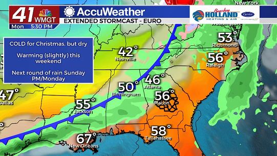
On Monday, a cold front will push through the area bringing a chance for scattered showers.
After the front passes we will get another drop in our high temperatures back to the low 50’s.

Leave a Reply