


Warm temperatures start the new week
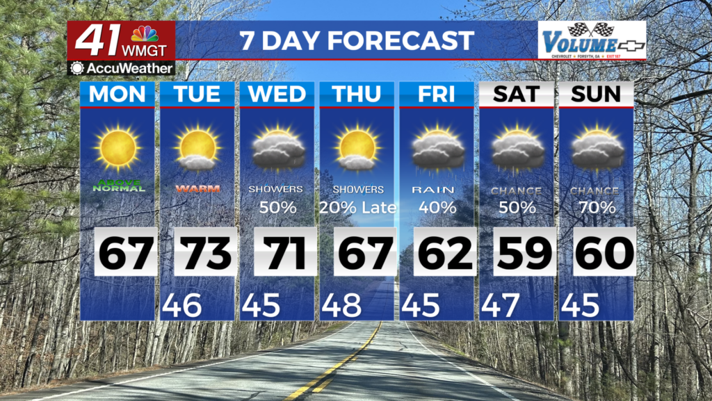
MACON, Georgia (41NBC/WMGT) – With a stream of warm, moist, southwesterly flow setting up across the Southeast along the northern fringes of a high pressure system situated to the south, 


North and Middle Georgia are set to kick off the week on a warming trend. Light radar returns are showing light showers however, conditions are too dry to show those light showers reaching the surface. Highs this afternoon will rise into the 60s to near 70 areawide, as much as 12-15 degrees above average for this time of the year. Moisture associated with a shortwave traversing mid level flow over the course of the day supports increased cloud cover overnight into Tuesday, leading to warmer lows in the 40s on Tuesday morning. Tuesday will be similarly warm and dry, with highs topping out in the low to mid 70s. Warmer than normal temperatures continue through Thursday with the overall pattern of ridging continuing, with only a shortwave push of energy moving through the overall flow into Wednesday and Wednesday night. This will increase rain chances for Wednesday especially in the northwest portion of the state as a front pushes into the area. Rainfall totals are light at least less than a quarter of an inch. By Thursday, ridging sets back into place with temperatures continuing to reach 10 degrees above normal. Despite the warmer than normal temperatures, it doesn’t look like that any records would be broken. Moving into Friday, another wave of moisture looks to move into the area which will increase rain chances going into the weekend.