


Warm and dry weather lasts through the weekend
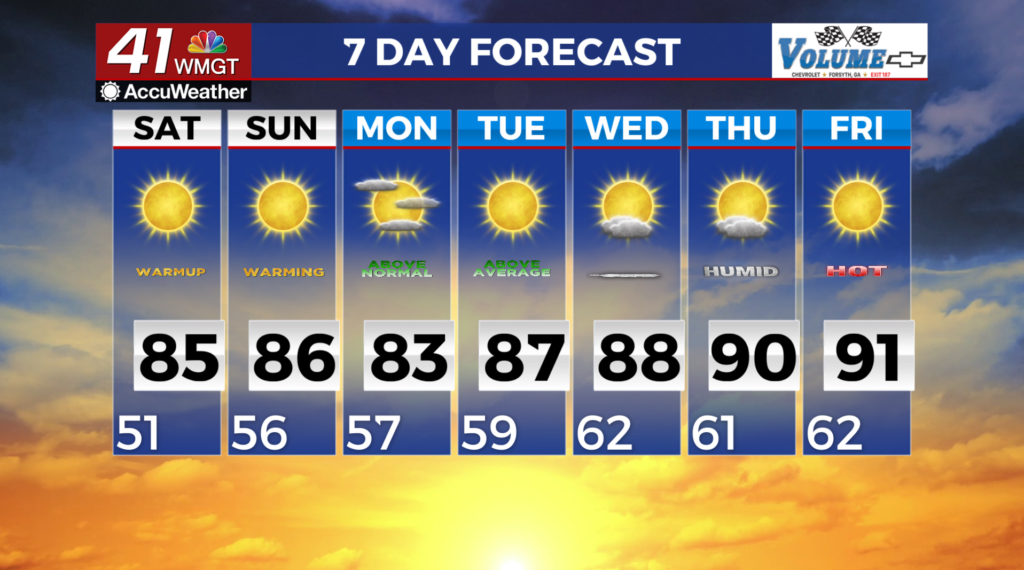
MACON, Georgia (41NBC/WMGT) – A high pressure regimen persists across the region through the weekend. A mid-level ridge is extending from the Central Gulf Coast northeastward towards 


New England and will amplify. Surface high pressure underneath of the ridge is centered over the Southeast and Appalachian. This will keep dry conditions and mostly clear skies in place across north and Middle Georgia. As the center of the high meanders towards Georgia, winds will gradually decrease and become light and variable by this evening. A warming trend will also begin underneath this pattern, which will continue through the weekend and into next week. Low temperatures will range in the 50s. Minimum relative humidity values have ranged from about 22 to 30 percent across most of north Georgia. Even though relative humidity values are borderline, and ongoing drought conditions, and very dry fuels, a Fire Danger Statement will be in effect throughout the weekend. Tonight into early Saturday morning, a trough moves across the Great Lakes region, with an associated low lifting through the Northeast towards the North Atlantic. A cold front trailing from the low will approach from the north. As the parent low continues towards the northeast, the front loses support and dissipates over the Tennessee Valley region. No precipitation is expected with this system. As this trough continues to move, the high pressure pattern persists with another broad ridge and surface high advancing from the Central U.S. and fills in over the Southeast on Saturday. Temperatures will be quite warm, rising into the mid 80s across the area. In spite of gradually moderating dewpoints, the increasing temperatures will eventually lead to the likelihood of hazardous fire weather conditions and a Fire Danger Statement once again on Saturday afternoon. Relative Humidity Values are forecast to range from 20 to 30% with no improvement to fuels and drought conditions.