


Unsettled weather continues into midweek
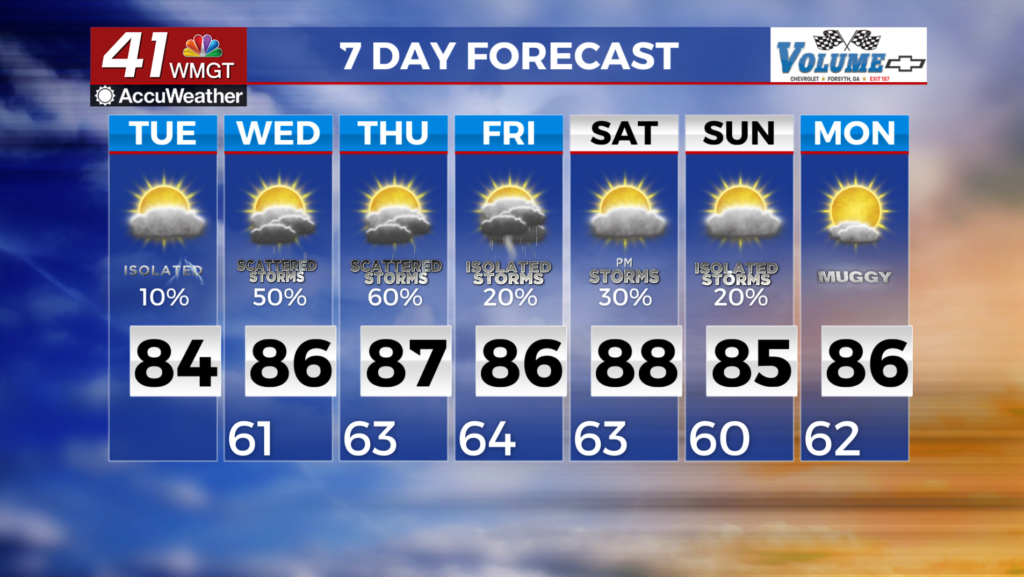
MACON, Georgia (41NBC/WMGT) – For the long term, a weakening cold front will stall near the northern Georgia border. High pressure is just to our east and troughing to our west with small weak vorticity this will lead to increased daily rain chances. With the frontal boundary over north Georgia, this will be the main location for most of the shower and thunderstorm activity.  This will look like a bit of a summer-type pattern with no real dynamic forcing in the area. Most of the showers will be fueled by daytime heating and weak shear resulting in the pop-up type of showers and thunderstorms. At this time, we are not expecting any severe weather. Towards the weekend, another front will stall over the area, reinforcing the existing pattern. With moisture in the area and no real frontal passage to help cool down temperatures, much of the area will be unseasonably warm with high temperatures in the mid to upper 80s (10-15 degrees above normal for this time of year). Lows will also be warm – in the lower 60s across much of the area.