
Tuesday cold front brings gusty winds and cooler temperatures
The first Monday of 2020 brought above average temps and plenty of sunshine, but a cold front is on the way that will bring the chance of a few showers and a bit of a cool down.
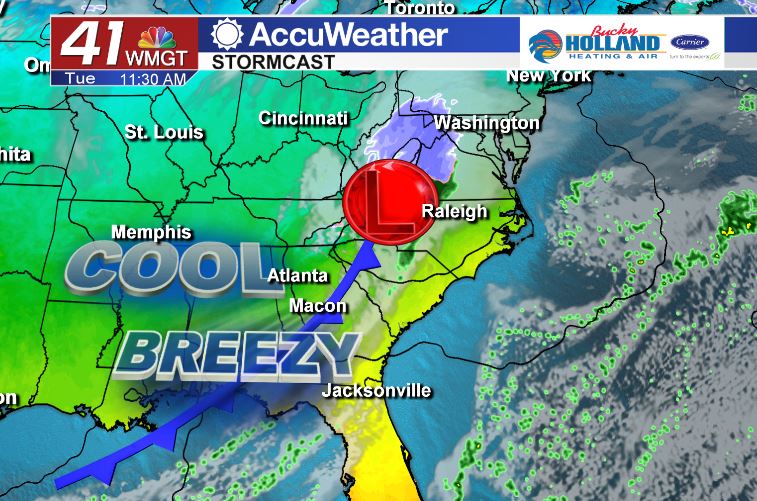
By Tuesday afternoon a cold front will bring clearing of our clouds and some breezy conditions to Middle Georgia. Expect wind gusts up to 20 mph by the afternoon.
Temperatures will quickly dip into the 30’s by Wednesday morning as cold air settles back in across the area.
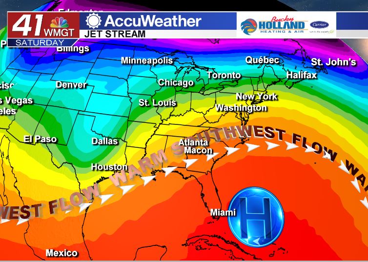
High pressure to our south will send a warm southwesterly flow into Middle Georgia by the end of the week. This will warm our high temps to the 70’s through the end of the week. It will also help to usher in more moisture and humidity by the weekend.
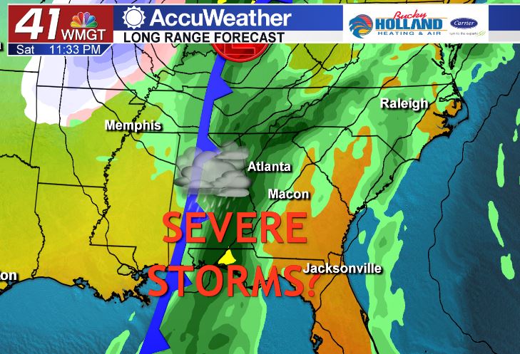
Speaking of the weekend, we are watching the chance of strong to severe storms in our western counties. Signals are pointing to the potential of strong to severe storms across the southeast on Saturday into Sunday.
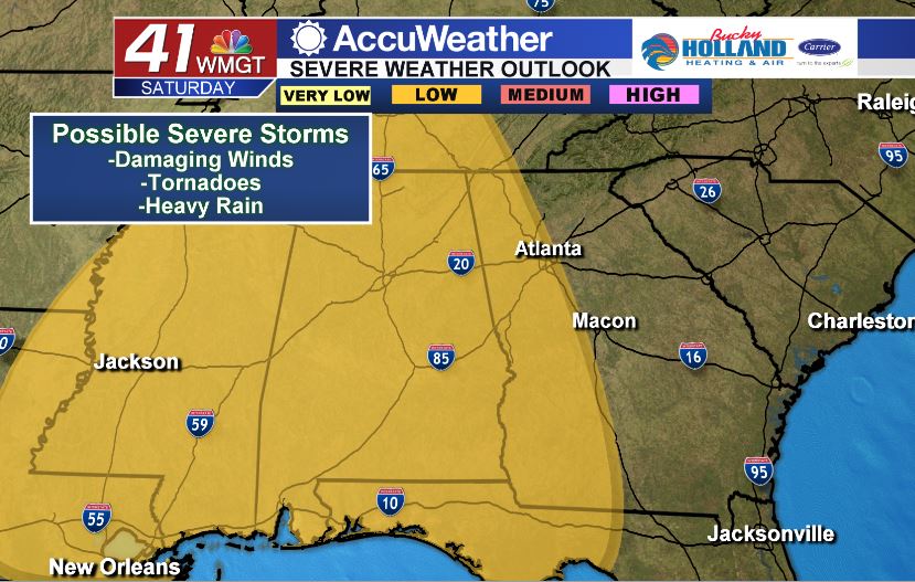
It is still pretty far out forecast-wise, but the possibility of severe weather will hang around beginning Saturday afternoon. Based on the latest forecast most of Middle Georgia will see storms by early Sunday morning.
It might be too early to say what exactly the threats will be, but signals point to damaging winds and possibly tornadoes.
Stick with 41 NBC for the latest forecast through the weekend.


Leave a Reply