


The dry out begins
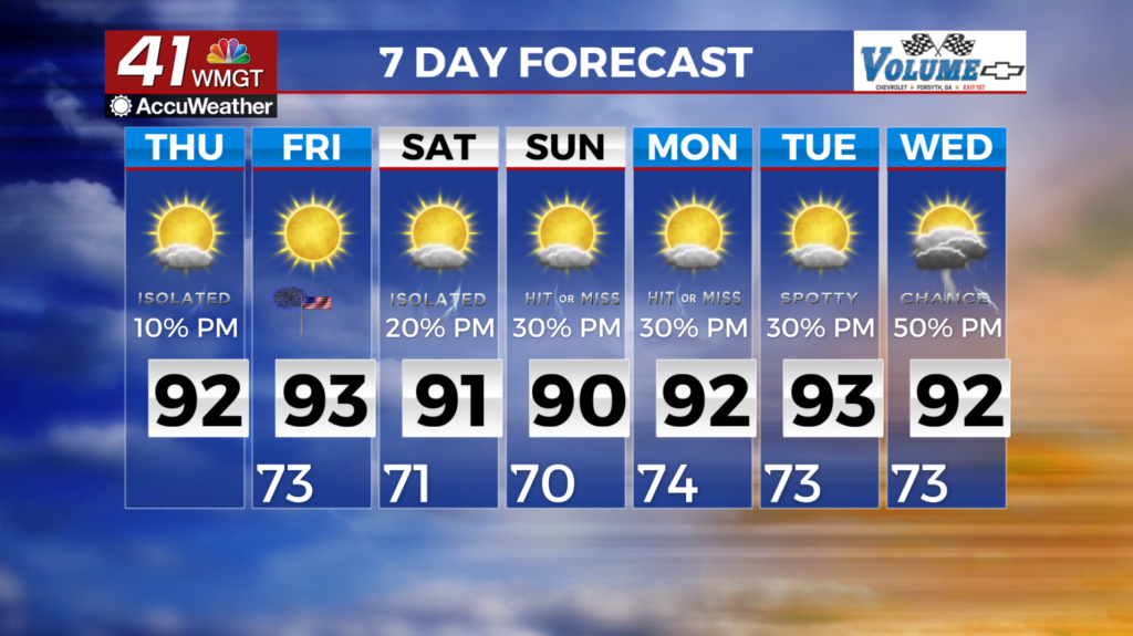
MACON, Georgia (41NBC/WMGT) – Compared to some of the previous days, we finally have a relatively tame forecast on tap for the short term. Shower chances remain slightly elevated in  Middle Georgia as moisture is pooled ahead of a mostly stalled front currently sitting over the I-85 corridor. Behind the front skies have mostly cleared. The trough that brought the front initially into the area has progressed out into the Atlantic. Another trough will follow in its wake across the Northeast. Tonight the cold front will continue to progress further south and will be reinforced by the trough moving across the Northeast. This will keep most of the area dry tomorrow, with the exception of East Central Georgia where a few isolated storms will be possible. Severe weather is not anticipated. Highs this afternoon will reach the upper 80s to low 90s. Lows tonight will be in the upper 60s to lower 70s. Tomorrow relatively drier air will filter in and bring temps to the upper 90s across much of the area. Heat indices will range from the lower 90s in the north to the upper 90s in Middle Georgia each day.