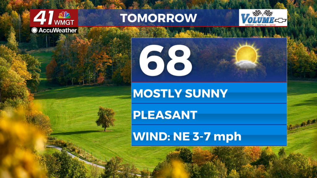
Temperatures gradually increase, as rain stays
MACON, Georgia (41NBC/WMGT) – The southeastern U.S. remains under the effects of a wedge of high pressure. This is resulting in the cloud cover that remains draped over northern and 


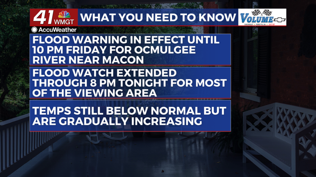
 Middle Georgia. Little to no clearing is expected today. Drizzle and light to moderate rain continues over the region, with increasing rain expected to develop through the afternoon. Over Middle Georgia, heavy rain and isolated to scattered thunderstorms are expected. A deep-layer trough is in place over Alabama into central Tennessee/Kentucky, and an upper-level jet is in place over the Appalachians into north Georgia. Thunderstorms will develop today as a result of the surface wedge and upper level air flow. Also, there is significant moisture in place over the region than what is seasonally typical. Because of this, heavy rainfall is likely. This will extend the flooding threat across most of the state. Tomorrow brings a gradual trend towards drying out. Moisture levels will slowly decrease through the day tomorrow, approaching seasonally typical amounts by late tomorrow evening. Drier air will filter in over Georgia, and the drizzle/rain risk will linger longest over central Georgia southward. Isolated thunderstorms are also possible during the afternoon into the evening. Temperatures will also remain well below seasonal normals. Daytime highs will be in the upper 70s to upper 80s over Middle Georgia.