Sunshine and warm temperatures return Saturday, storms possible Sunday
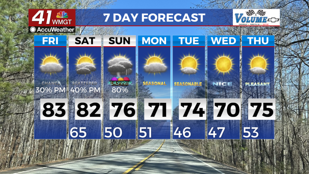
Saturday will be a beautiful day across Middle Georgia, with clear skies and highs in the 80s. Severe storms will be possible Sunday

We saw the last of our rain and storms move out early this evening in Middle Georgia, leaving us with a nice, dry night.
Tomorrow will bring a beautiful spring day to the area, with clear skies and highs in the 80s.
By Saturday evening clouds will push in, ahead of our next round of showers.

There is a chance that a few showers, lingering from a system in Alabama, will push into the area, late Saturday.
Right now it looks like instability will be pretty low as these storms move through.
With the low instability, we are not expecting severe weather overnight.


By Sunday we will see a conditional chance of severe storms.
I say conditional because we will need to see a few things come together even to get any kind of rain.
Above are two of our models, both showing very different solutions.
To the left is the possibility that storms form to our south, blocking inflow to any new storms.
To the right is a solution that would not have anything blocking inflow, allowing for strong storms to form by the afternoon.
So pretty much, we could see some rain, no rain, or scattered severe storms…

The Storm Prediction Center has already put Middle Georgia under a level 2 severe weather outlook for Sunday.
The main impacts from any storms will be heavy rain, gusty winds, isolated tornadoes, and large hail.
Stick with 41NBC for the latest on this forecast.

Once the front moves through Sunday evening, clear skies will be the name of the game for next week.
After a “cool” start Monday, we will see a warm-up through the week back to the mid and upper 80s.