Sunny Wednesday ahead of strong storms Thursday
Clear skies finally moved back into Middle Georgia this afternoon, bringing sunshine and a bit of a warm up.
Through the evening, lows will be dropping into the 20’s (a hard freeze), so be sure to protect your pets, pipes, and plants.
Through the day tomorrow, sunshine will be sticking around, but enjoy it while it is here, because changes are quickly on the way.
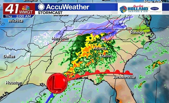
An area of low pressure will move north from the Gulf of Mexico, bringing heavy rain and thunderstorms to the area as early as late Wednesday.
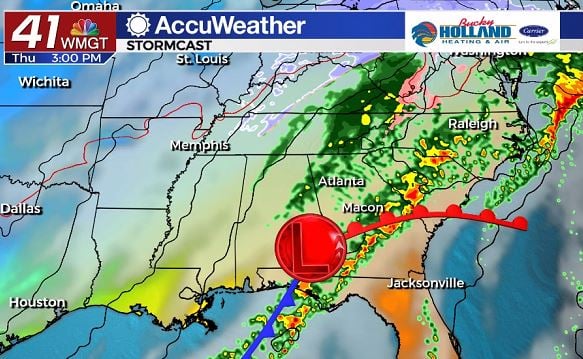
By late Thursday morning into Thursday afternoon, we will see the warm front lift north into parts of Middle Georgia.
As the front lifts our chance of severe storms will be increasing, especially rotating storms.
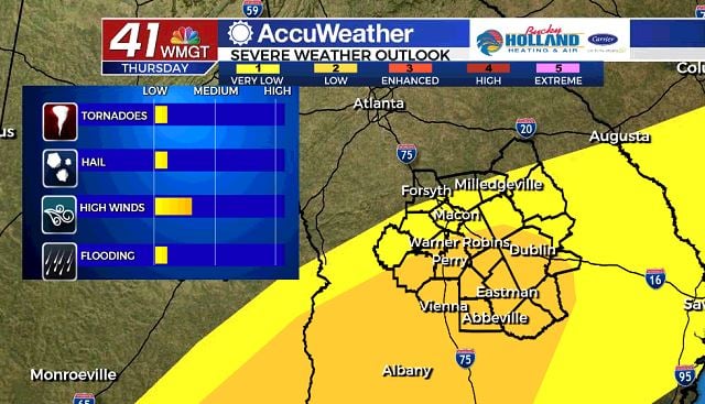
The Storm Prediction Center puts much of Middle Georgia under a level 2 threat for severe storms on Thursday.
Damaging winds, isolated tornadoes, and large hail will be possible with storms that form Thursday.
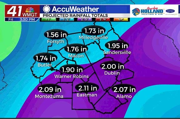
We will also be watching closely for the potential of heavy rain that could lead to flash flooding.
1-2″ of rainfall are expected in a 24 hour period and could lead to both urban flooding as well as pond and stream flooding.
Stay weather aware through Thursday and have multiple ways to get your severe weather warnings.
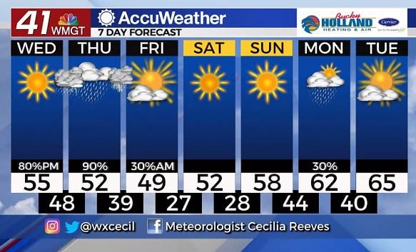
Once the storms are gone, we will get a nice break from the rain, just in time for the weekend, but we will also be seeing a quick cool down.
Sunshine will stick around through Sunday and accompany a slow warm up to the upper 50’s and low 60’s.
A few showers will be possible Monday, before we see a nice warm up into the 60’s for much of next week.


Leave a Reply