Sunday Alberto Update
Good evening!
Hope you are enjoying your Sunday! Alberto (as of 2:30pm) is still a subtropical storm in the Gulf of Mexico. Expect to see a few bands of moderate rainfall through the afternoon and evening hours across Middle Georgia. The real threat moves in mainly on Monday.
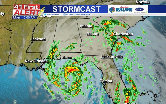
Monday AM: Several bands of rain and storms from Alberto will likely move through the area. In these bands, an isolated tornado could be possible as well as very gusty winds and heavy rain. Flash flooding will be the main concern across the area, as we already have saturated soil, and there is really just nowhere for that additional rain to go.
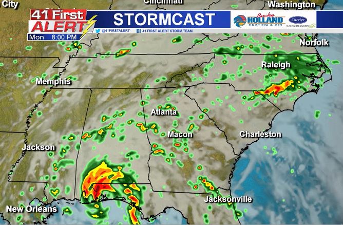
Monday PM: The storm threat continues overnight Monday, as well as the additional threat for flooding and isolated tornadoes. By tomorrow we will have a better idea of how long Alberto will be hanging around the southeast, but our rain chances hang around through the week so be ready for the potential for flooding through the week…again. 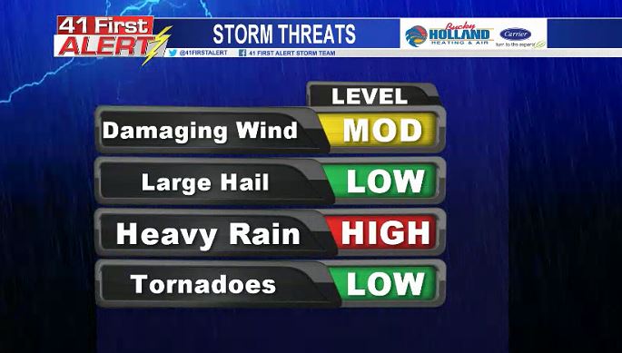
Flooding remains the #1 threat through the week (definitely feeling like a broken record here). An additional 2-4″ of rain is possible across Middle Georgia. The heavy rain, combined with the possibility of gusty, tropical storm force, winds, could very well lead to downed trees and potentially power lines. Be ready to deal with a potential power outage as the storm moves through the southeast.
If anything changes in the forecast we will be sure to update you, and Kristen will be in, bright and early to help you get through this mess on 41NBC Daybreak!
Have a safe Memorial Day Weekend
Chief Meteorologist Cecilia Reeves


Leave a Reply