Summertime storms continue for Friday
MACON, Georgia (41NBC/WMGT) – Moving into the latter portion of the week, we begin to lose our persistent pattern of troughing and shift toward a more quasi-zonal pattern as the Bermuda 

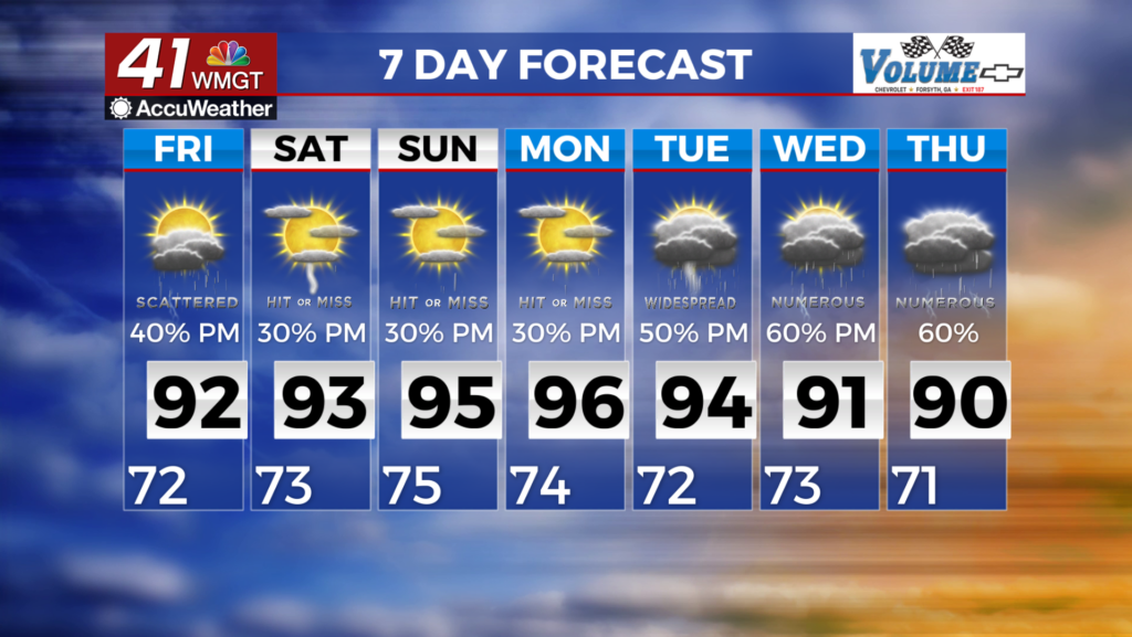
 High moves westward. Deep layer flow continues to support the conveyor belt of moisture into the Southeast, reinforced by moisture-rich southwesterly flow along the western edge of the Bermuda High. As a result of our moist environment, we will see the potential for precipitation-loaded downdrafts to produce isolated damaging wind gusts in the strongest storms. A Marginal (level 1 out of 5) Risk has been issued across nearly all of north and Middle Georgia. In concert with the slightly bolstered severe chances, lack of steering flow will mean that storms that form may move little and perhaps even back build at times. Widespread flash flooding concerns are not anticipated. Little change is forecast moving forward into Friday and similar conditions are to be expected, with scattered to numerous thunderstorms developing through the afternoon. Highs tomorrow will be in the mid-80s to mid-90s. Humidity will feel like 98 to 104 degrees. Lows will drop into the 60s to lower 70s.