


Summertime heat and high index values return for Tuesday
MACON, Georgia (41NBC/WMGT) – For the long term we will be in a hum/drum heat pattern. Tropical moisture will continue to feed into the Southeast courtesy of southwesterly flow around the 

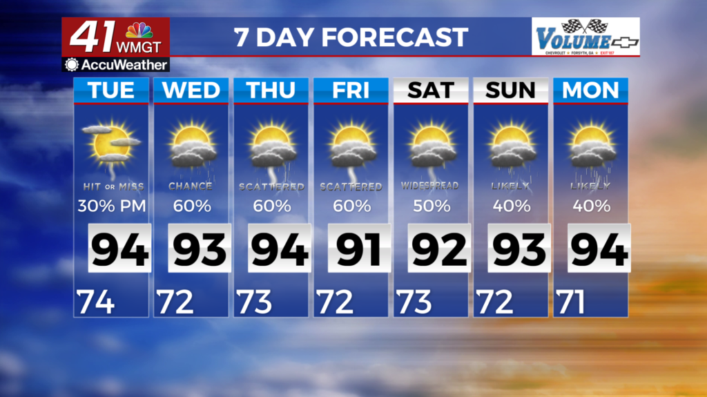
 Bermuda High. We expect each day will bring at least scattered if not widespread diurnally-driven showers and thunderstorms. Any weak disturbances could amplify the intensity of daily convection. In true Georgia summertime fashion, a few storms each day could be strong to severe, with gusty to localized damaging winds, heavy rainfall and frequent lightning. Generally speaking, the potential for widespread/organized severe weather remains low. If anything, the weak flow aloft may support slow-moving or stationary storms that produce heavy rainfall over a given area for an extended period of time. Showers and storms and the resulting cloud cover will have a big impact on how high heat index values climb each day. In general, values will range from 100-105 degrees across much of Middle and Eastern Georgia each day. Isolated locales could have values reach 108-110 degrees. Be sure to take frequent breaks, limit your time outdoors if possible, and stay hydrated!