
Strong storms possible Tuesday
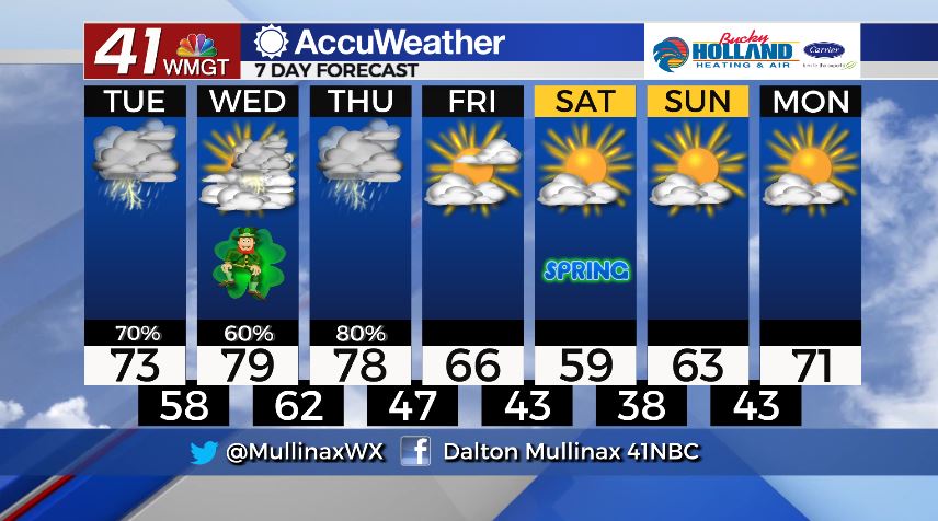
MACON, Georgia. (41NBC/WMGT)- A few strong storms are possible today as temperatures climb back into the 70’s.
TODAY.
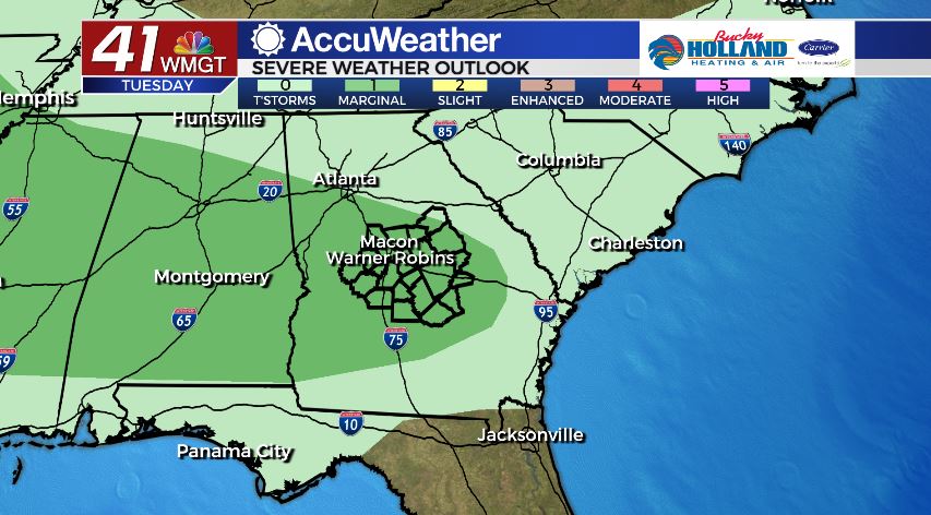
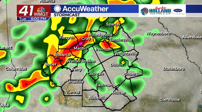
Under mostly cloudy conditions temperatures will climb into the low and middle 70’s by the afternoon. Isolated morning showers will become more numerous as we move into the afternoon. With added instability thanks to daytime heating, a few storms could become strong or severe this afternoon and evening. The main storm threat looks to be damaging wind gusts. Tonight, our severe weather potential decreases as we just keep a few showers around.
TOMORROW.
St. Patrick’s Day looks to be quieter for the daytime hours. Showers and storms will fire back up in the late evening. Temperatures will warm to near 80° tomorrow afternoon as the sun comes back out.
THURSDAY.

This is a day to be weather aware. A dynamic storm system will bring an increased chance for severe weather to our area beginning early Thursday morning and continuing into the day. Along and just ahead of a cold front we could see gusty winds, heavy rain, and the potential for tornadoes.
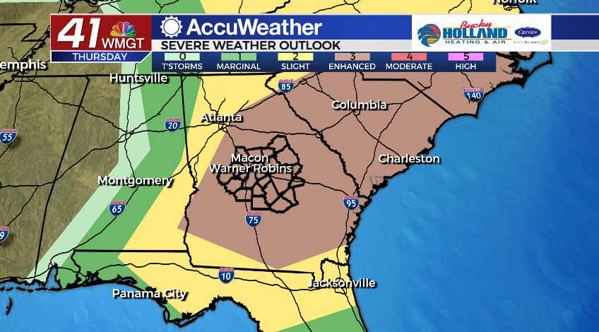
The details will need to be ironed out in the time leading up to the event, so stay tuned to our team.
Follow Meteorologist Dalton Mullinax on Facebook (Dalton Mullinax 41NBC) and Twitter (@MullinaxWX) for weather updates throughout the day. You can also watch his forecasts Monday through Friday on 41NBC News at Daybreak (6-7 a.m.) and 41Today (11 a.m).

Leave a Reply