
Few strong storms possible on Tuesday
MACON, Georgia. (41NBC/WMGT) – As a cold front approaches Middle Georgia today, storm chances will be on the rise.
TODAY.

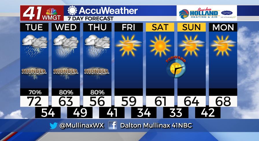
A cold front moving in from the west today will bring showers and a few embedded storms to Middle Georgia this afternoon and evening. Temperatures today will top out in the upper 60’s and lower 70’s under a mostly cloudy sky.
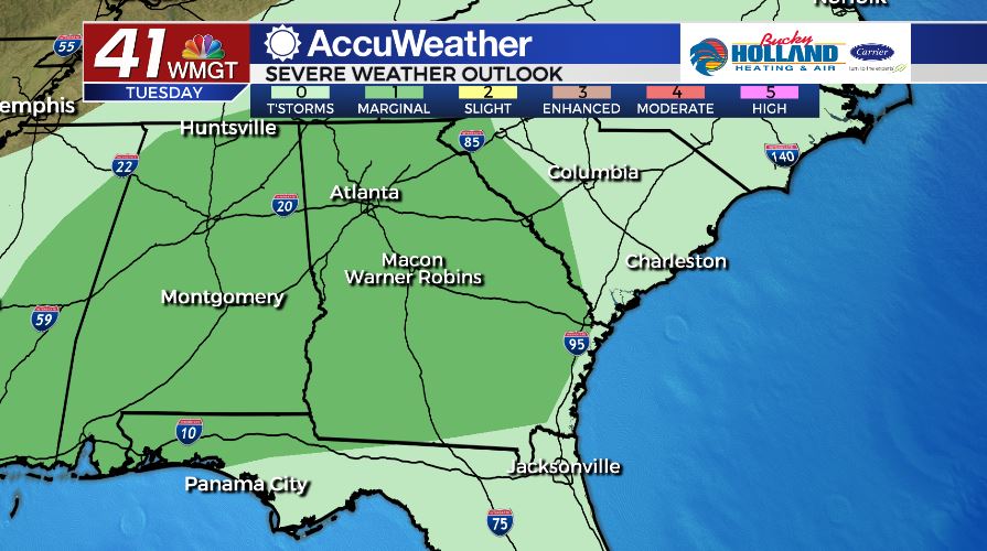
As of 6 am on Tuesday, March 3, the Storm Prediction Center has placed all of Middle Georgia in a Marginal (level 1/5) risk area for today. The main storm threats will be damaging wind gusts and heavy rain. Our tornado threat for today is low, but not zero. A brief, spin-up tornado is possible.
Tonight, temperatures will fall into the middle 50’s under a mostly cloudy sky. A few showers will hang around through the overnight as well.
TOMORROW AND THURSDAY.
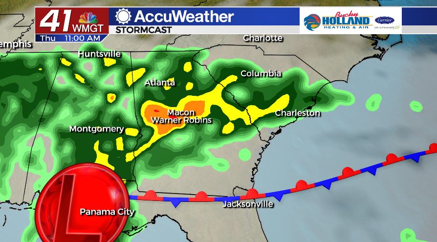
Today’s cold front will stall out to our south tomorrow setting up for waves of rain tomorrow and Thursday. Temperatures will be cooler behind the cold front with highs forecast to make it into the low and middle 60’s. We are even cooler on Thursday with temperatures forecast to make it into the middle 50’s during the afternoon.
FRIDAY AND BEYOND.
FINALLY! Dry air moves in Friday and lasts through early next week. We will be mostly sunny and dry through the weekend. Temperatures will be in the upper 50’s on Friday afternoon and will warm into the upper 60’s by Monday.
Follow Meteorologist Dalton Mullinax on Facebook (Dalton Mullinax 41NBC) and Twitter (@MullinaxWX) for weather updates throughout the day. You can also watch his forecasts Monday through Friday on 41NBC News at Daybreak (6-7 a.m.) and 41Today (11 a.m).


Leave a Reply