


A few strong storms are possible today
MACON, Georgia. (41NBC/WMGT)- As a trough digs east across the southeast today, a few strong storms are possible.
TODAY.
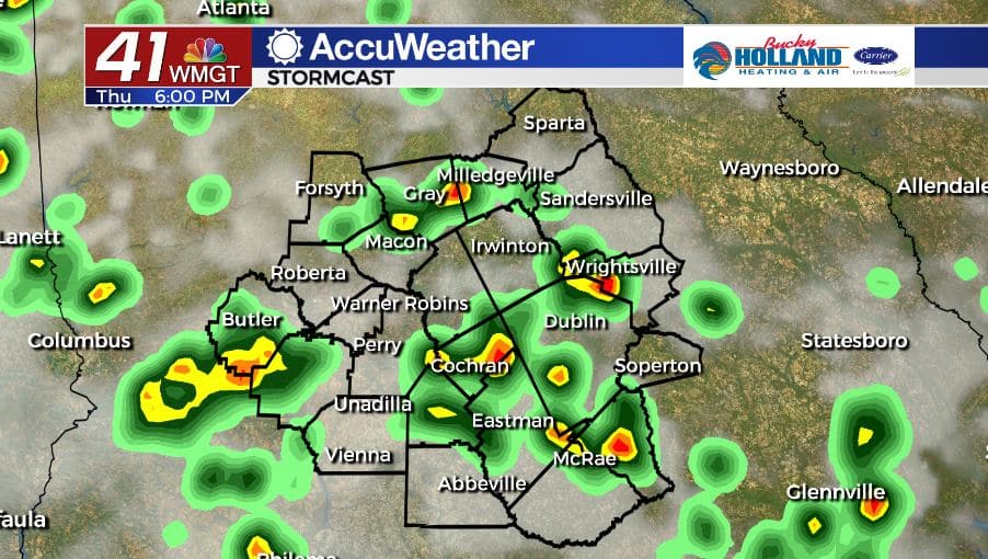
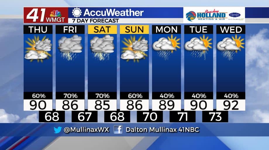
Under a partly sunny sky, high temperatures will be topping out right around 90° across Middle Georgia. Scattered showers and storms will begin moving through the area as we head into the afternoon and evening hours. A few strong storms are possible with damaging wind gusts and frequent lightning being the main storm threats.
A few showers are expected to continue into the overnight hours. Temperatures will fall into the upper 60’s and lower 70’s under a partly cloudy sky. Patchy fog is possible by daybreak on Friday.
TOMORROW.
TGIF! More cloud cover and rain showers move in for the final day of the work week. Temperatures will only be making it into the middle and upper 80’s. If you have any Friday night plans you will definitely want to keep the umbrella handy as showers and a few storms are expected to last through the night.
WEEKEND & BEYOND.
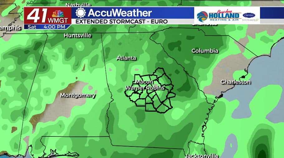
It’s not going to be a washout, but showers and storms are likely on both days of the weekend. Temperatures will hold steady in the middle to upper 80’s as well. Isolated coverage of showers and storms return next week as temperatures warm back into the low 90’s.
Follow Meteorologist Dalton Mullinax on Facebook (Dalton Mullinax 41NBC) and Twitter (@MullinaxWX) for weather updates throughout the day. You can also watch his forecasts Monday through Friday on 41NBC News at Daybreak (6-7 a.m.) and 41Today (11 a.m).

Leave a Reply