


Strong storms leads to colder temperatures for Monday into Tuesday
MACON, Georgia (41NBC/WMGT) – A very active and dynamic weather system has brought severe weather followed by much colder temperatures. At this time, all severe watches and warnings 


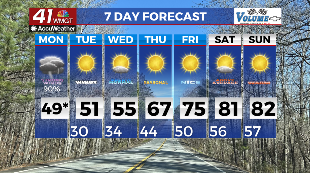
for our immediate viewing area have been lifted, however, we still have a freeze warning in effect until 10 AM Tuesday. This line brought damaging winds and a few spin-up tornadoes. This environment also supported a few cellular or classic string of pearl type of formation which was ahead of the main line. The cold front has ushered in significant cold air expected to arrive by Monday evening. Temperatures may drop fast enough that a secondary frontal development on the backside of the system may develop pockets of a light snow shower. No significant accumulations are expected at this time and any snow showers will be brief. Winds will also continue into the overnight hours with gusts of 30+ mph across much of the area. These winds should calm slowly overnight Monday, however wind chills may drop to near 20 degrees for many areas. A Wind Advisory could be issued if these winds continue to trend upward. A Freeze Warning is in effect for the entire area for below freezing temperatures Monday night into Tuesday morning. Freezing temperatures return Tuesday night into Wednesday morning as well. The extended forecast from Tuesday through Saturday of this week will remain rather tranquil weather-wise with temperatures starting much cooler and trending warmer by the weekend.