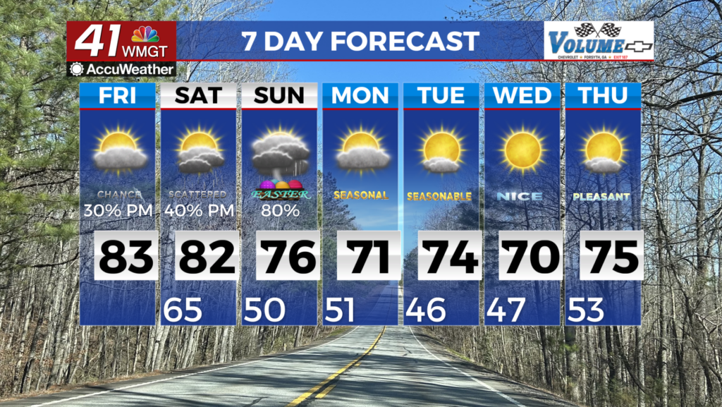
Storms possible today, Dry Saturday
MACON, Georgia (41NBC/WMGT) – Good morning to you all! Hope your Friday is off to a good start! This morning we are in the 50s. A level 1/5 threat for severe weather has been issued for today. Some strong winds, small hail, or perhaps a brief tornado will be possible. The timing for severe storms will likely be this afternoon to early evening before storms weaken and become showers heading into the overnight hours. This is all due to a weakening line of storms to our west. Temperatures for today will make it to the 80s. Saturday is expected to offer a respite from the rain, though there may be a few showers in the early hours. While showers are more probable in the southern areas of the region, they could occur sporadically throughout Middle Georgia as the cold front stalls and lingers to the south. After a cloudy morning, the afternoon will see highs climbing into the upper 70s and lower 80s, with skies clearing to mostly sunny by evening. Cloud cover will gradually return overnight, leading into Sunday. On Sunday, both St. Patrick’s Day and the Cherry Blossom Parade coincide in downtown Macon. If you’re headed to Dublin for St. Patrick’s celebrations, be sure to bring an umbrella or raincoat as rain is expected during lunchtime. In Macon, where the parade kicks off at 3:00 PM on Sunday, anticipate some rainfall as well, with showers likely between 1 and 4 PM in the afternoon.