Storms end Thursday afternoon, dry weather returns late week
Rain and storms have been hanging around Middle Georgia this evening after a day of record warmth.
More rain and storms will be possible overnight with warm conditions sticking around as well.

Good news in the Gulf (for Middle GA) is that Eta will be making landfall early tomorrow morning as a tropical storm.
Eta will then quickly move across to Jacksonville and into the Atlantic by Thursday night. We will get a nice break from the tropics for at little while once Eta moves out to sea.
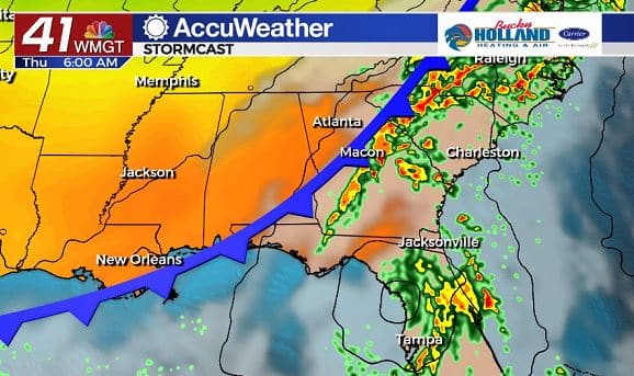
Here at home we are mostly awaiting a cold front that will be pushing through and continuing our storm chances.
Based off the location of the front and the latest weather models, it looks like we will see storms refiring early tomorrow morning, with clearing happening pretty quickly behind the front.
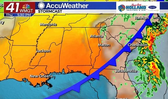
We could start seeing clearing of the skies as early as tomorrow afternoon. A few isolated showers will be possible behind the front, but most of us will be dry by tomorrow night.
Dry air will start moving in on Friday and bring a pleasant weekend to Middle Georgia.
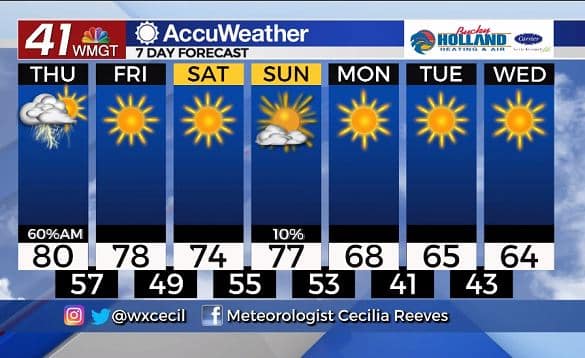
A cold front will push through the area on Sunday (yes, another one) that will bring significant cooling for next week.
Sweater weather will be here for a few days, but be ready for temps by the end of next week to warm back up a bit.


Leave a Reply