Storm chances increase through the end of the week
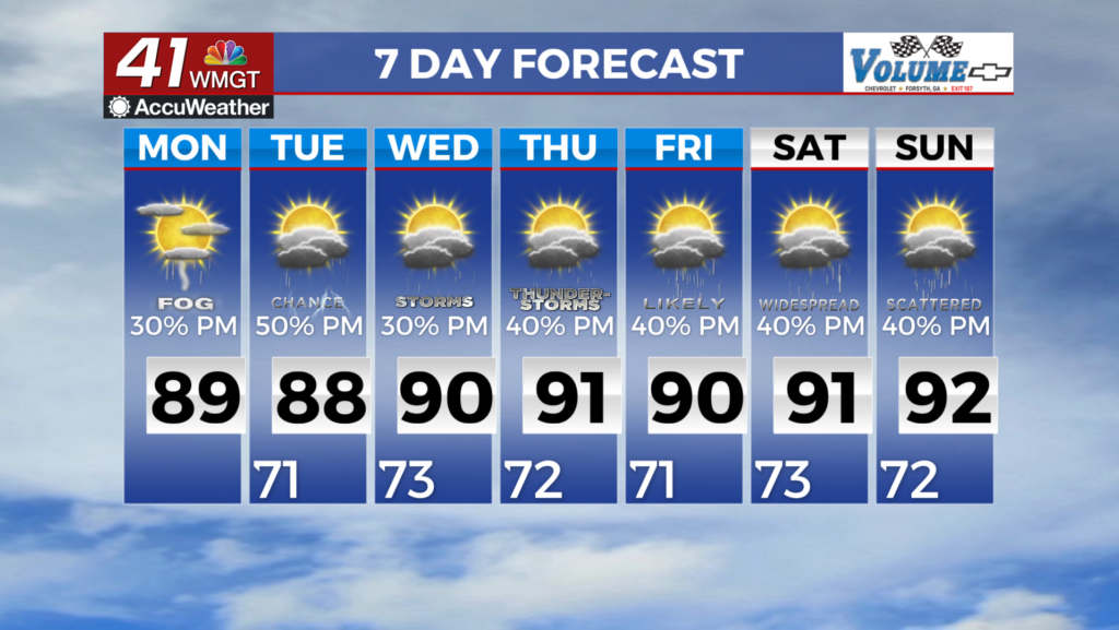
MACON, Georgia (41NBC/WMGT) – The frontal boundary has stalled across Southeast Georgia creating an increase for shower and thunderstorm development in the afternoon. The main area of 


storms extending from the Athens to Macon to Columbus areas and south. With the frontal boundary stalled we will stay in very moist west to southwest flow through the short term. This will keep diurnally driven convection chances elevated. We should see another round of storms very similar to what we saw Sunday. There will be some increased backside moisture across North Georgia Tuesday as the main low will be centered over the Georgia/South Carolina/Tennessee triple point borders. This will allow moisture to wrap around the backside of the low into northwest Georgia 

bringing slightly elevated precipitation chances in. The cloud cover and precipitation will keep temperatures mainly in the 80s to near 90 across the area through the short term. North and Central Georgia will remain in moist southwest flow through the midweek as a cutoff low sits over the Tennessee Valley. From late week into the weekend, models are in pretty good agreement on the pattern slightly shifting as the low gets kicked out by a ridge building in from over the Atlantic. Overall, this pattern will support fairly typical summer weather, with scattered to numerous afternoon showers and storms each day of the upcoming week. High temperatures will initially be in the 80s to low 90s mid week due to increased cloud cover and proximity of the mid-level low, but will gradually warm up to the low to mid 90s by the weekend as the ridge builds in.