Staying hot, hazy, and humid for the rest of the work week
MACON, Georgia. (41NBC/WMGT)- Our stagnant weather pattern continues Wednesday with another round of showers and storms in the forecast.
TODAY.

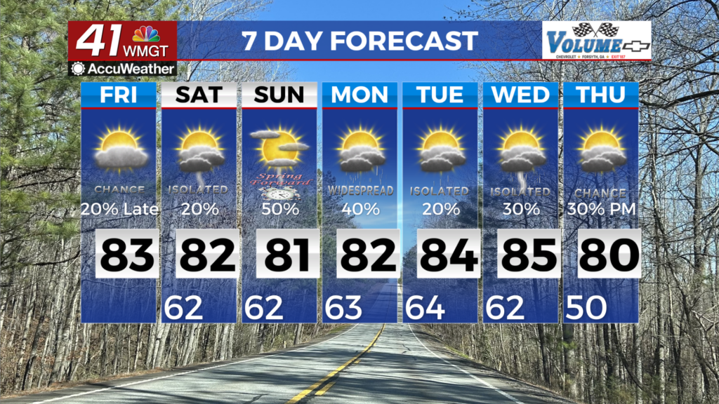
Temperatures today will be back in the low and middle 90’s with heat index values topping the century mark. Scattered showers and thunderstorms will move through periodically throughout the afternoon and evening. Tonight we will keep a few of those showers around as temperatures fall into the low and middle 70’s.
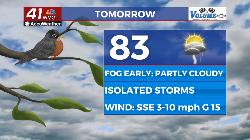
TOMORROW.

Rain chances will remain elevated Thursday as temperatures soar into the middle 90’s under a partly cloudy sky. Temperatures tomorrow night will fall back into the low 70’s which is seasonable for this time of year.
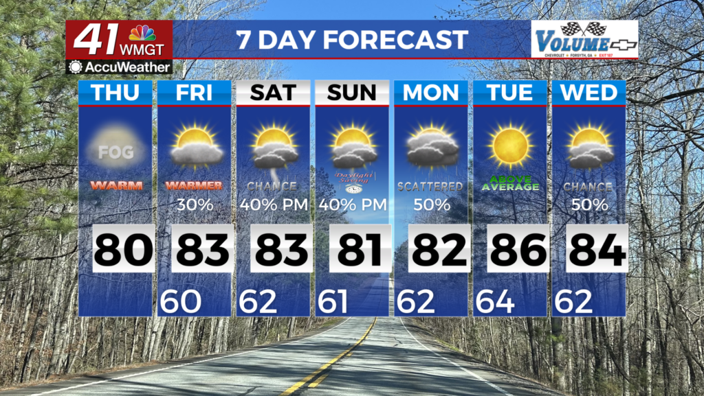
FRIDAY & BEYOND.
Friday and the weekend will be mostly dry with the exception of a few isolated downpours. Tropical Storm Fred was named Tuesday night and is making its trek across the Caribbean.

As of 5 am on Wednesday, August 11, Tropical Storm Fred is closing in on Hispaniola. Once the storm interacts with land and emerges on the other side of the island we will have a better idea of our potential impacts along with timing.

RIGHT NOW, it appears and impacts from Fred will be on Monday and Tuesday of next week. Heavy rain, breezy conditions, and the potential for spin-up tornadoes is possible with the current forecast information. Our forecast can and will change in the coming days. Please stay tuned for more information.

Follow Meteorologist Dalton Mullinax on Facebook (Dalton Mullinax 41NBC) and Twitter (@MullinaxWX) for weather updates throughout the day. Also, you can watch his forecasts Monday through Friday on 41NBC News at Daybreak (6-7 a.m.) and 41Today (11 a.m).

Leave a Reply