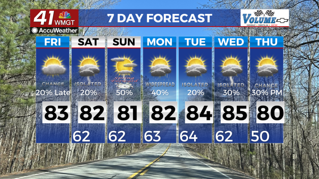
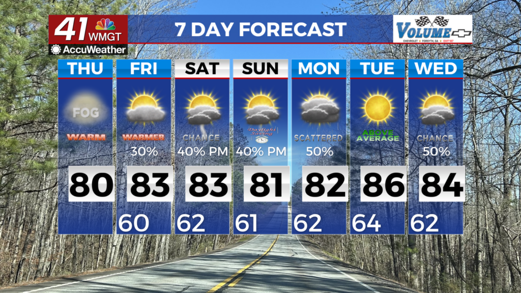
Staying hot and mostly dry Thursday
MACON, Georgia. (41NBC/WMGT)- A few downpours are likely today as temperatures climb back towards the middle 90’s.
TODAY.
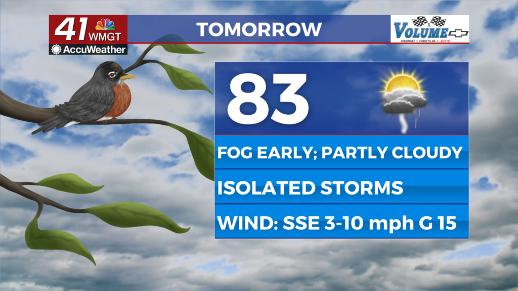
A lot of sunshine is on the way Thursday as a mostly dry day is in store! Temperatures will warm into the low and middle 90’s across the region. A few showers are possible as we head throughout the afternoon and evening, but overall rain chances remain low. Tonight, under a mostly clear sky, temperatures will fall into the low 70’s. Patchy fog formation is not likely overnight.
TOMORROW.

We will wrap up the work week with showers and storms becoming fairly widespread during the afternoon and evening hours. Temperatures will top out near 90° but will feel closer to 100° thanks to the humidity. A few showers will linger into the night, but Friday evening plans should be a go! It will be warm and muggy with temperatures slowly falling into the low 70’s by early Saturday morning.
WEEKEND & BEYOND.

Showers and storms will be present throughout the weekend, but overall coverage will be limited. High temperatures will stay in the low 90’s. All eyes are on the Caribbean as a tropical disturbance looks to move into the Gulf of Mexico during the weekend. As of 5 am on Thursday, August 26, this disturbance has a 90% chance of forming in the next two days as it moves northward. For the time being it looks as if our impacts from this system will be minimal. We will keep an eye on it and bring you updates.

Follow Meteorologist Dalton Mullinax on Facebook (Dalton Mullinax 41NBC) and Twitter (@MullinaxWX) for weather updates throughout the day. Also, you can watch his forecasts Monday through Friday on 41NBC News at Daybreak (6-7 a.m.) and 41Today (11 a.m).

Leave a Reply