
Staying dry ahead of a stormy(potentially severe) weekend
A cold front pushed through Middle Georgia earlier today, but we didn’t see much in the way of rain or chilly temperatures during the day.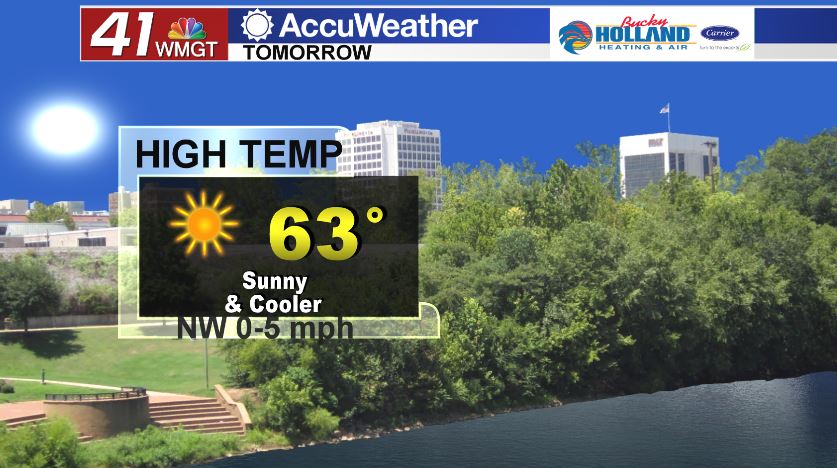
Wednesday will bring a cold morning with clear skies. Sunshine will stick around through the day as we warm up into the low 60’s.
Conditions will stay quiet Wednesday and Thursday with plenty of sunshine, before rain and storms move into Middle Georgia.
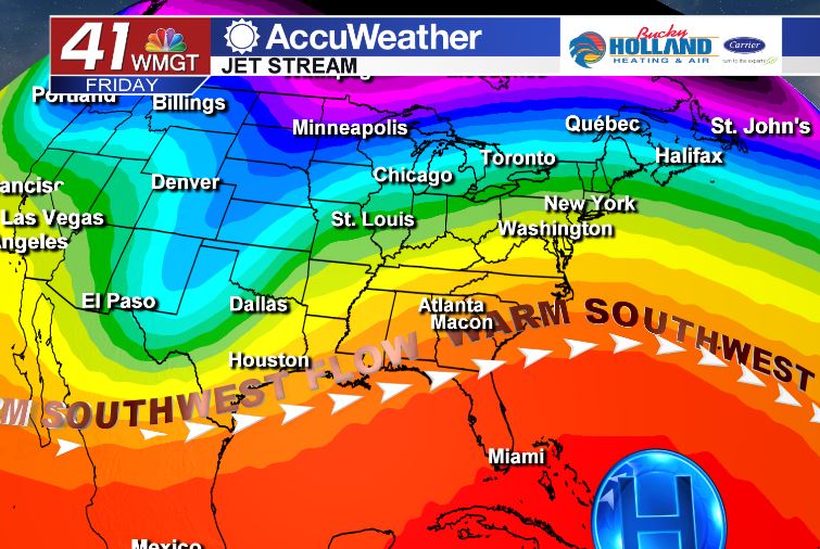
By Friday, rain chances return but so does a warm southwesterly flow. High temperatures will soar into the 70’s through the end of the week and into the weekend.
Low temperatures will only drop into the 60’s over the weekend, but the main focus will be on severe weather potential.
Combining the warm, moist southwesterly flow with a cold front pushing in from the west, much of the southeast will see the possibility of severe storms over the weekend.
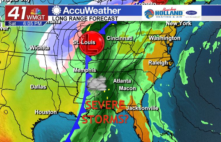
Timing of storms right now looks to be Saturday afternoon or evening.
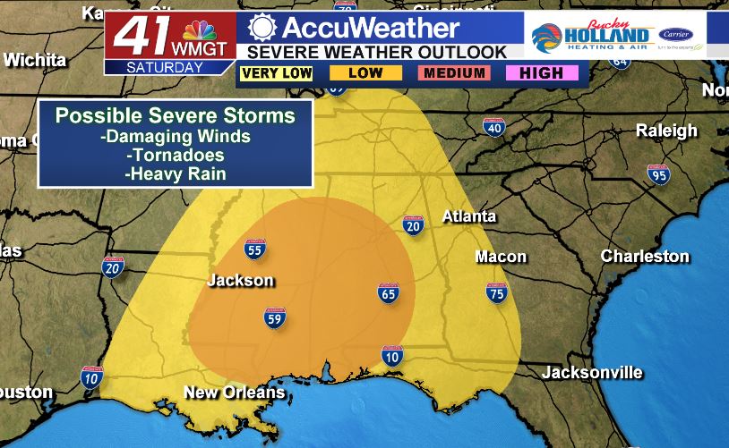
While it is still about 4 days out, the general forecast looks to bring the main threats as strong damaging winds and tornadoes. Heavy rain will also be possible along and ahead of the cold front.
We will continue to watch the forecast closely, but right now the western portion of Middle Georgia will likely see the biggest impact of Saturdays storms.


Leave a Reply