Sprinkles likely as Spring-like temperatures hang on
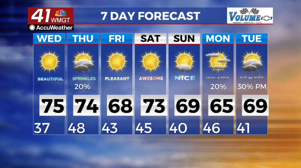
 MACON, Georgia (41NBC/WMGT)- High pressure has settled over the Southeast which has promoted dry conditions through Wednesday. Temperatures will continue to warm. High temperatures on Wednesday will feel downright spring-like; in the 70s across the region and approaching 80 in portions of east-central Georgia. These highs will be 10 to 15 degrees above daily averages. Also, relative humidity values are near critical fire danger levels. This is due to very low relative humidity levels of less than 25 percent. The ridge will begin to weaken as a trough drops through the Midwest. By Wednesday night a low near the Southern Great Lakes will extend a cold front through the Tennessee Valley.
Clouds will increase across North Georgia ahead of the front, though precipitation chances will hold off until late Thursday. Our rain chances have decreased due to the uncertainty of the amount of available moisture for the
passing of the upper level trough and the cold front to work with. If showers do occur they are most probable in the afternoon. Thunderstorms are unlikely with this event due to limited instability.
.