Spring-like temperatures headed this way
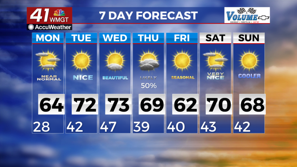
MACON,GEORGIA (41NBC/WMGT) – Early morning clouds with possible sprinkles will start off Monday. Morning lows
will remain above freezing for most of the region. Lingering clouds will clear north to south later today with mostly clear
skies by afternoon. Highs will warm into the lower 60s areawide. This is where we should be for late February.
For the long-term beginning Tuesday morning conditions will be spring-like. High temperatures on Tuesday and
Wednesday will both be near 60 and 70 degrees respectively. A building subtropical ridge on Thursday may be enough
to possibly provide an increase in moisture just ahead of a cold front.
Any precipitation on Thursday will come in a line of showers with a few rumbles of thunder Thursday afternoon. Due to
limited moisture and a weak cold front, the line will likely be broken, thin or raggedy.
With the cold front passage, conditions Friday forward dry out once again. Temperatures behind the front may drop,
although conditions will still be warmer than current. Highs will remain between 60 and 70 degrees for most of the area.