Spring-like even Summer-like temps round-out the week
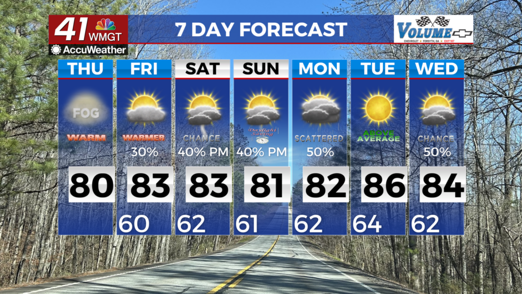
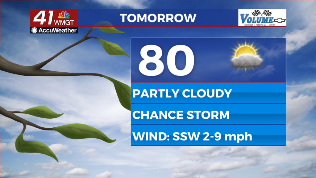
MACON, Georgia (41NBC/WMGT) – The combination of slightly higher relative humidity and a high pressure ridge will produce unusually high temperatures today. Morning lows in the 50s 


are expected Thursday morning, and a few degrees warmer for Friday morning. Afternoon highs on Thursday will warm to the upper 70s to low 80s. The extended forecast will be characterized by a more summer-like weather pattern than early March as the region remains on the western side of the subtropical ridge extending from the Atlantic. Very warm temperatures can be expected each day with highs and lows both running about 15 to 20 degrees above normal for early March. At least a few daily temperature records are likely to be reached or broken during this time period. Looking at the precipitation side of things, scattered daytime driven showers and thunderstorms will become the rule from Friday into the weekend. The ridge will slide a bit farther east, allowing the frontal zone to nudge farther southeastward into the Tennessee Valley. A series of upper shortwaves working through the southwest flow aloft brings opportunities for scattered showers and thunderstorms, particularly across the northwest half of the area. Ensemble guidance continues to support thunderstorm activity, although better dynamics will remain displaced north and west of the area. For this reason, any significant severe threat looks to remain situated to the west and northwest of our area. The next real pattern change looks to hold off until Wednesday or Thursday of next week, at which point a stronger system and front look to sweep into the area, but any details regarding this system will remain forthcoming over the week ahead.