


Slow warming trend begins mid-week
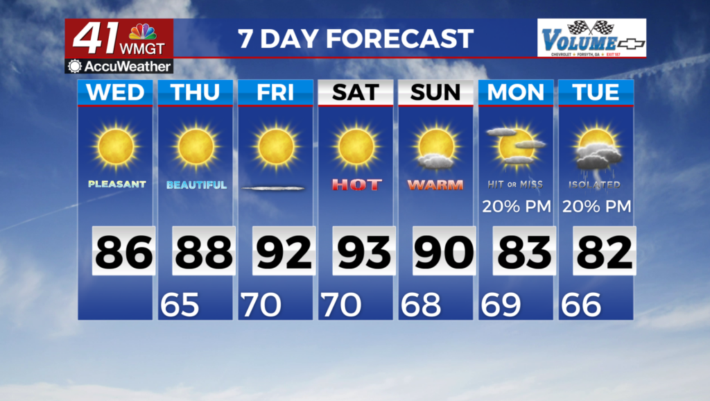
MACON, Georgia (41NBC/WMGT) – Wednesday will see the wedge start to break down as a much stronger system begins to sweep into the Upper Midwest and a surface low off the East Coast 


 moves away. Air flow at the surface should begin to shift more southerly, however, moisture return will take some time. Highs on Thursday will be a bit warmer, but seasonable, as a result. Best rain chances will remain across northern Georgia where better overall moisture availability remains. Daytime driven showers and storms are expected Thursday evening (to the north) before a shortwave pushes through the overall troughing pattern over the Eastern U.S. This shortwave will push a frontal boundary into the area into Friday morning which should usher in dry air for the day limiting rain chances. By Saturday another shortwave pulse looks to move through the overall flow pushing with it another frontal boundary which will have a bit more moisture behind it. Rainfall amounts are expected to remain light. Models are split on whether the front stalls in Middle Georgia or further south into Florida. Temperatures despite the frontal passage will range from 3 to 8 degrees above normal before moderating closer to normal by mid-week.