

Slight moderation in temps begins today
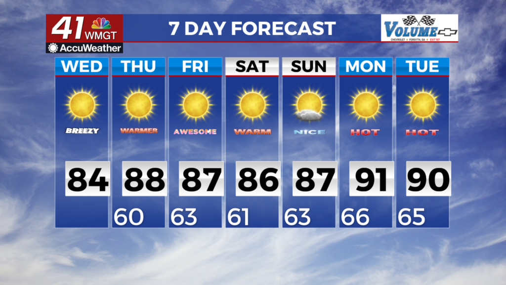
MACON, Georgia (41NBC/WMGT) – Dry air remains in place over northern and Middle Georgia. High pressure will remain in place, helping to sustain dry, sunny conditions, with the nearest 


 moisture being associated with a stationary front that remains in place over the northern part of the peninsula of Florida. Temperatures are expected to increase somewhat today compared to yesterday, with daytime highs in the mid 70s to upper 80s. That being said, with so little moisture in place, heat indices are not expected to be any higher than those mid 70s to upper 80s. Overnight lows will be in the low 50s to near 60 tonight and tomorrow night. The extended forecast remains dry through the period. Persistent troughing over the eastern U.S. and high pressure at the surface will keep precipitation chances low across north and Central Georgia. In general, expect afternoon temperatures in the mid 80s to near 90 by Thursday, and plateauing through the weekend. Overnight lows should stay largely in the 60s. Unfortunately, beyond the weekend looks to stay similarly warm and dry, which could be a recipe for rapid drying of soils and flora. If you have not already, it may be time to water outdoor plants again as the heat returns.

