Showers & T-storms start off Monday, dry week starts Tuesday
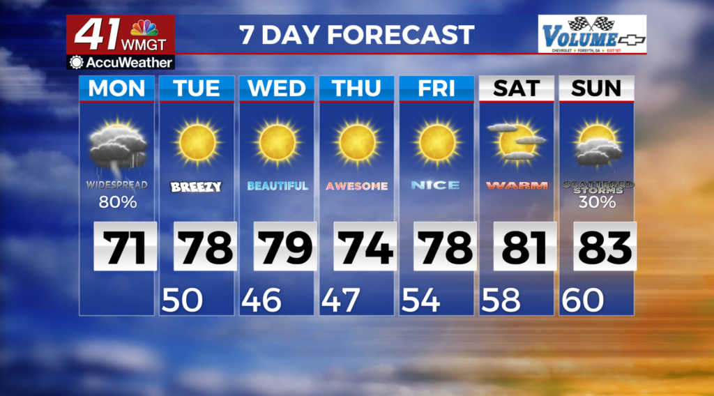
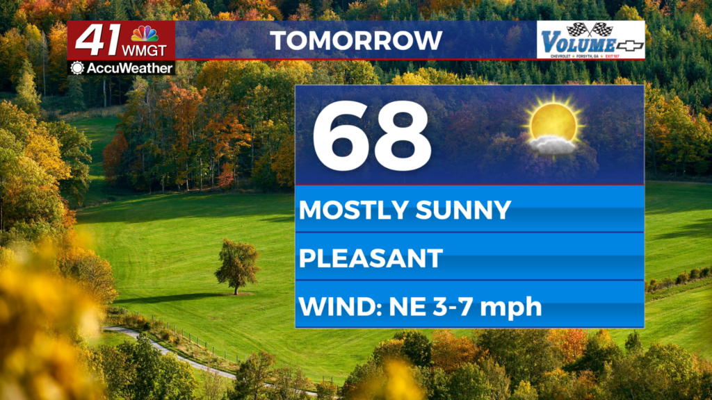
MACON, Georgia (41NBC/WMGT) – High pressure ridge clears Georgia to the east. Winds have shifted to the south on the back side of the high. Temperatures continue to warm, as temperatures are running above normal in the mid 70s. Wind speeds are expected to increased as a tightening pressure gradient will increase moisture in the dewpoints. Low relative humidity and dry fuels have warranted the issuance of a Fire Danger Statement across the region. The cold front will advance into North Georgia Monday morning. The front will become more elongated from the southwest to northeast as a parent low becomes occluded. There should be enough moisture and forcing ahead of the front to support widespread showers. Instability is expected to be fairly limited. Rainfall amounts can range from 0.25 to 0.5 inches, although some locally heavier amounts will be possible where stronger convection occurs. A few strong thunderstorms capable of producing gusty winds will be possible and severe weather cannot be ruled out. The most likely time window for showers and thunderstorms is expected around 4 am to 8 am continuing to advance south and east thereafter. By early Monday afternoon, north Georgia will be rain-free as dry air and breezy northwest winds behind the front start scattering out lingering cloud cover. Isolated to scattered showers will continue in portions of Middle Georgia through the late afternoon before coming to an end. High temperatures on Monday afternoon will run close to normal, ranging from the upper 60s to low 70s.