


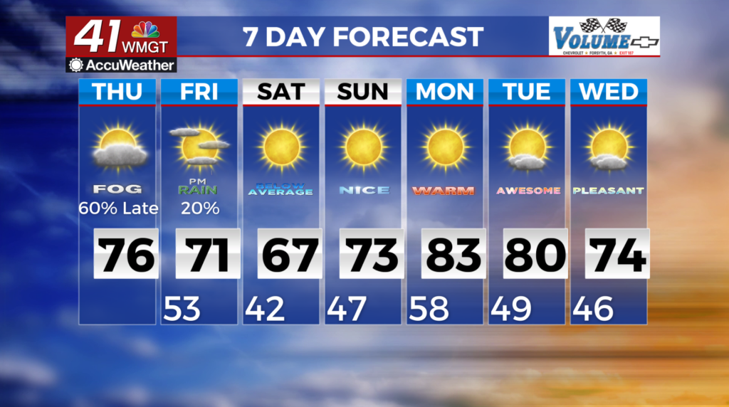
Showers on the way, then dry stretch begins for the weekend
MACON, Georgia (41NBC/WMGT) – A shortwave trough is situated off the east coast and is moving out into the Atlantic. A stronger shortwave dives out of central Canada with a deepening 
 upper low forming across the Great Lakes. Mid level energy continues to dig into the base of this trough with the strongest energy moving across portions of north Georgia later today. This energy will provide lift to any convection that develops and moves in from the west. The models are showing some trends. Some are showing convection across the region, mainly north of I-20 by mid to late afternoon. Another shows more widespread convention in the form of a line forming late afternoon to early evening. Another model shows more organized convention moving into the area weakening as it pushes southward. This seems more reasonable since daytime heating will be lost. For this event, large hail and damaging winds gusts will be the primary severe weather hazard, along with an isolated brief tornado. For Friday, chance of rain showers. Temperatures will be below seasonable averages (6-12 degrees) cooler.