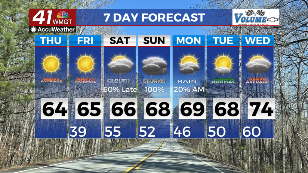
Showers and thunderstorms expected again today and Thursday

MACON, Georgia (41NBC/WMGT) – Weak low off the mouth of the Mississippi River with a northward extending trough axis draped across Alabama into northwest Georgia, similar to a 

 tropical wave. Moisture is pooling along the boundary extending north from Mobile Alabama northeastward into Georgia. We have enough surface heating to allow for instability to surge across the area which will serve as an aid in more widespread shower and thunderstorm activity later today and this evening. Expect heavier rainfall potential across northern Georgia this evening as storms develop and lift north across the area. The weak trough axis remains generally in place Thursday so expect a similar type set up with afternoon showers and storms developing. With no real midlevel or jet support, expect activity to be largely driven by surface heating or an aggressive Gulf coast sea breeze.