


Severe weather possible Tuesday morning, ahead of cool down
We have been closely monitoring severe storms in Mississippi, Louisiana, and Alabama.Those storms have had a history of producing strong tornadoes, including some that caused fatalities.
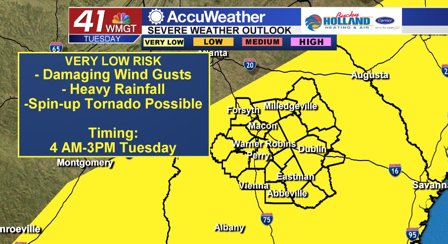
These storms are to be taken very seriously, that being said, once these storms push into Middle GA, we should see significant weakening. Even with weakening be sure to be ready for the potential of damaging winds, heavy rain, and a brief spin-up tornado.
Be sure to have multiple ways to get your warnings, especially a way that can wake you up if needed.
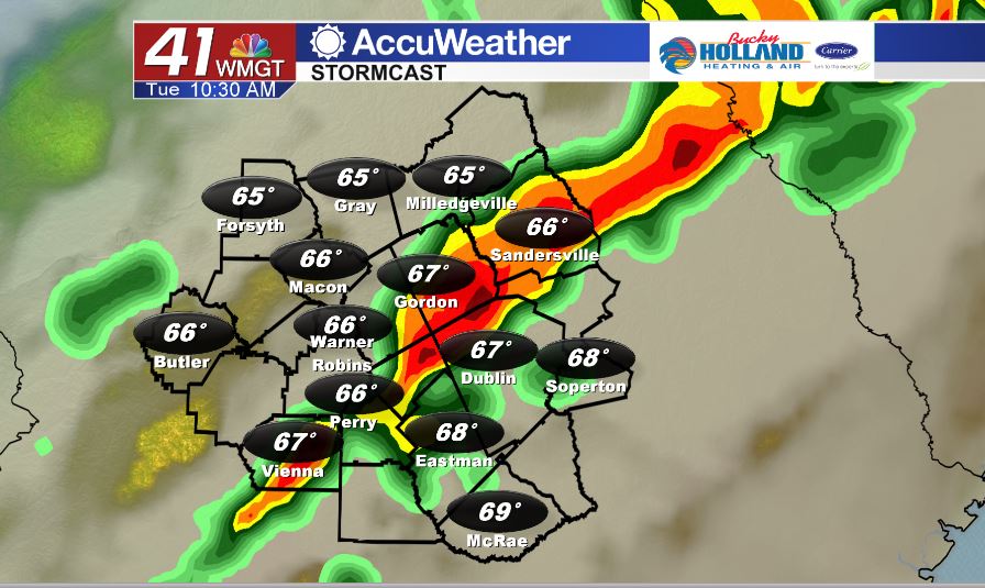
The earliest we are possibly going to see storm activity will be around 4 am. Likely the bulk of the storm activity moves in for the morning commute hours (pretty much any time after 6am). These storms will push through as a line with clearing and cooling just behind.
Temperatures through the day will top out during the morning in the upper 60’s and low 70’s. Through the rest of the day temperatures will be falling with gusty winds pushing into the area.
Be sure to tie down or bring in any holiday decorations that might blow away in strong winds.
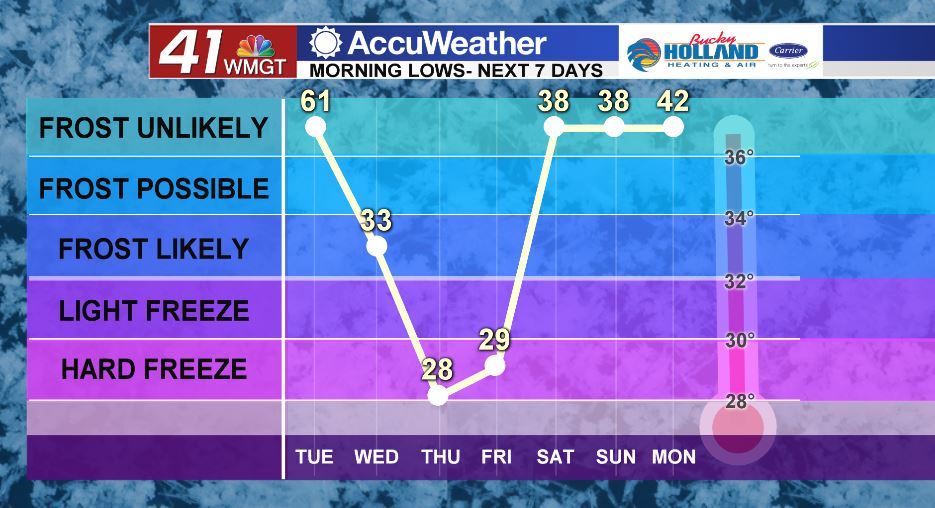
Behind the front we get quite a few dry days. Although it will be dry, we are anticipating a big cool down. Morning lows Thursday and Friday will drop into the 20’s ahead of a small warm up this weekend.
Leave a Reply