
Severe weather likely Thursday morning
The wedge front once again held strong through the early part of the afternoon, but we are now seeing the warm sector move north into Middle Georgia.
Through the overnight hours we will see a small chance for some severe storms with the threats for damaging wind gusts, isolated tornadoes and large hail.
This threat will be mostly done by around midnight, and we should get a bit of a break until tomorrow morning.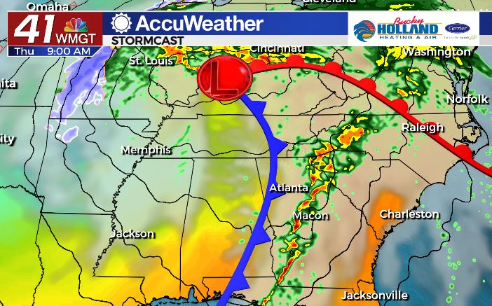
Through the day tomorrow a strong cold front will be approaching the area bringing a significant chance for severe storms.
Timing from some models is around 9am, but I think it could be earlier so I would be ready starting around 7am (maybe earlier).
Main take away with the timing issues on this is to have a warning method that will wake you up!
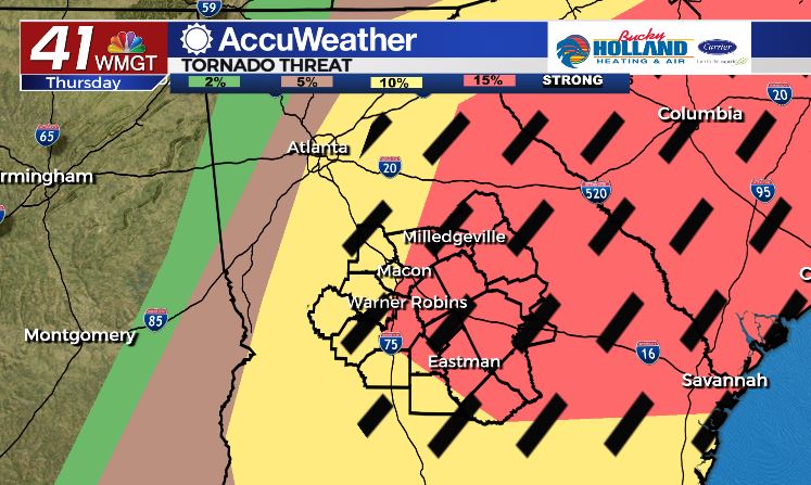
As the line moves through, strong, long track tornadoes will be possible, especially if we get some daytime heating going during the morning.
This is graphic above is from the Storm Prediction Center and shows the potential for those strong tornadoes and a 15% risk of a tornado. (they don’t issue these a whole lot, so take note)
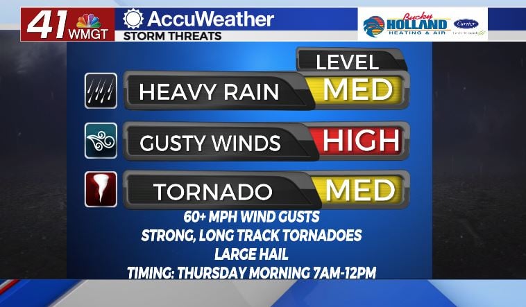
Just to reiterate, all kinds of severe weather will be possible as a squall line moves through the area tomorrow morning.
Know where your safe place is and make a plan to go there quickly, even very early in the morning.
Dalton and I will be in the weather center until this is through, so look for our updates tonight and tomorrow.


Leave a Reply