Severe weather lessens, heat remains
MACON, Georgia (41NBC/WMGT) – Significant severe weather unfolded for portions of North and Middle Georgia. Storm coverage has been clustered. Models suggest a large cluster or line of 


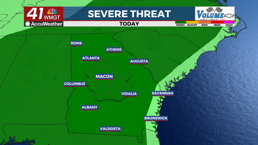
 storms developing over South Carolina drifting southwest into Eastern Georgia by 2 AM. In this environment very strong downburst winds are possible. Winds could range in the 60 to 80 mph range as well as large hail. This is an atypical event in that the storm motions are out of the East/Northeast and are moving rather slow. With that in mind localized flash flood risk can’t be ruled out. Expect another hot and humid day across Middle Georgia. Temperatures on Thursday will be a few degrees cooler with heat index values in most areas peaking around 100 degrees. As we move further into the day, we will have mostly clear skies, however, expect another round of afternoon and evening showers and thunderstorms, as well as hot and humid conditions. Coverage in storms will be higher than yesterday as the influence of the ridge lessens and the upper level low over Florida moves closer. The environment for a severe threat is less, but there will be still be plenty of instability to support damaging wind gusts. The Storm Prediction Center currently has the entire area in a Marginal Risk (Level 1 of 5) for severe weather.