


Severe threat over; long dry stretch ahead
MACON, Georgia (41NBC/WMGT) – A secondary wave of storms has already weakened and has moved through central portions of Georgia. An upper wave moves across the Tennessee Valley 
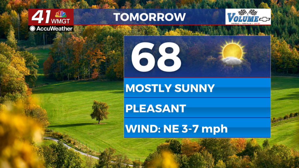
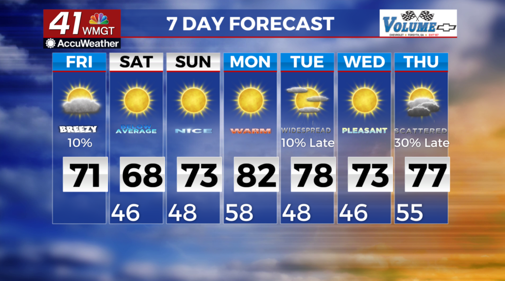
 later today. This will provide for cloud cover and breaks of sunshine as it moves by. A lingering shower is not out of the question. As we dry out, an area surface high pressure builds into the southeast over the weekend. This will combine with dry northwest flow to provide fair skies, mild temperatures and dry weather. Weakening pressure gradients will also lead to lighter winds, especially on Sunday. Cooler temperatures Friday night and Saturday night may lead to some frost/freeze concerns across northern Georgia. High temperatures will struggle on Saturday due to continued northwest winds. As a result, afternoon high temperatures should wallow in the lower 60s across North Georgia and claw their way into the upper 60s in Middle Georgia. A transition to westerly winds, continued low relative humidity, and sunshine should allow high temperatures to climb to within 1 to 3 degrees of seasonal averages on Sunday. Everywhere except the mountains can anticipate afternoon highs in the 70s.