
Severe storms possible Tuesday afternoon
After a few quiet weeks (severe weather wise) we are back in the thunderstorm game Tuesday.
An approaching low pressure system will bring the threat for all modes of severe weather. Damaging winds appear to be the greatest threat with this system, however isolated tornadoes and large hail are not out of the question.
As far as timing is concerned, a lot has to do with any storms that might form out ahead of the main system. These can help to temper the actual system as it moves in later. Don’t have much confidence that those will pop though, so expect the strongest storms anytime between 1 pm and 8 pm.
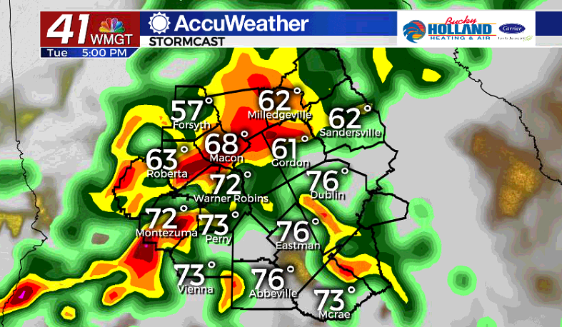
We will also see some periods of very heavy rain associated with this system.
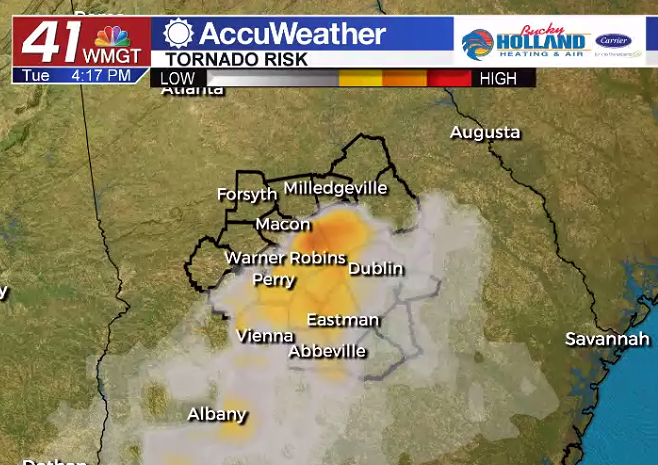
This is a metric we call the “Significant Tornado Parameter”. What has been the most troubling with this from run to run of the models, is the strong signaling moving further north.
That is why the Storm Prediction Center moved the Low Risk further to the north today, now including Macon and Warner Robins.
Everyone will need to have multiple ways to get your severe weather warnings. This means weather radio, television, 41 NBC Accuweather app, etc. DO NOT RELY ON SIRENS FOR SEVERE STORM INFORMATION! (Thank you for coming to my TED Talk)
Anyways we will keep updating you here and on television so make sure you are “following” our social media accounts.


Leave a Reply