
Severe storms possible starting Wednesday evening
After a few really nice days, the weather in Middle Georgia starts to take a turn for the worse, as our next system brings rain and storms to the area.
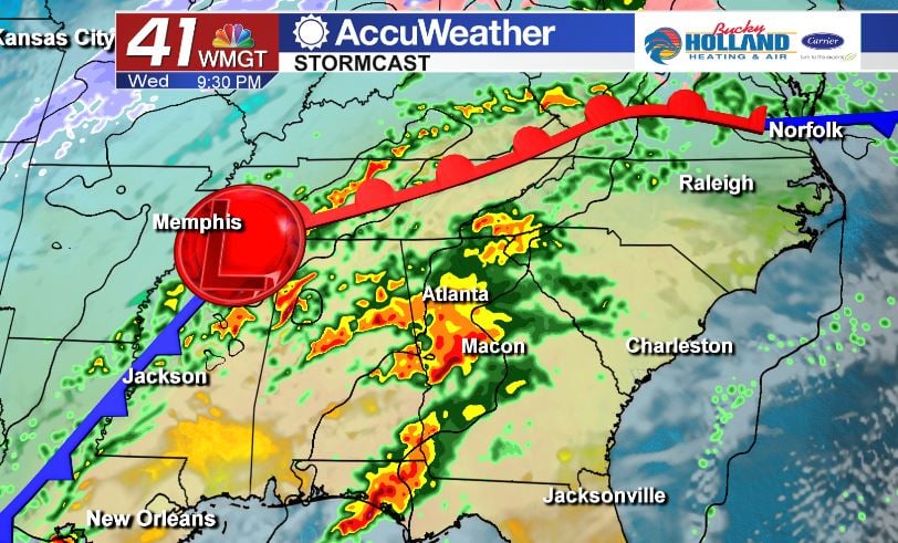
Tomorrow will bring a mostly cloudy day to Middle Georgia…this will be ahead of our chance for strong storms by the evening.
It will be another warm day with highs in the 70’s, but the increase in moisture will be noticeable. A few scattered showers will be possible through the day on Wednesday.
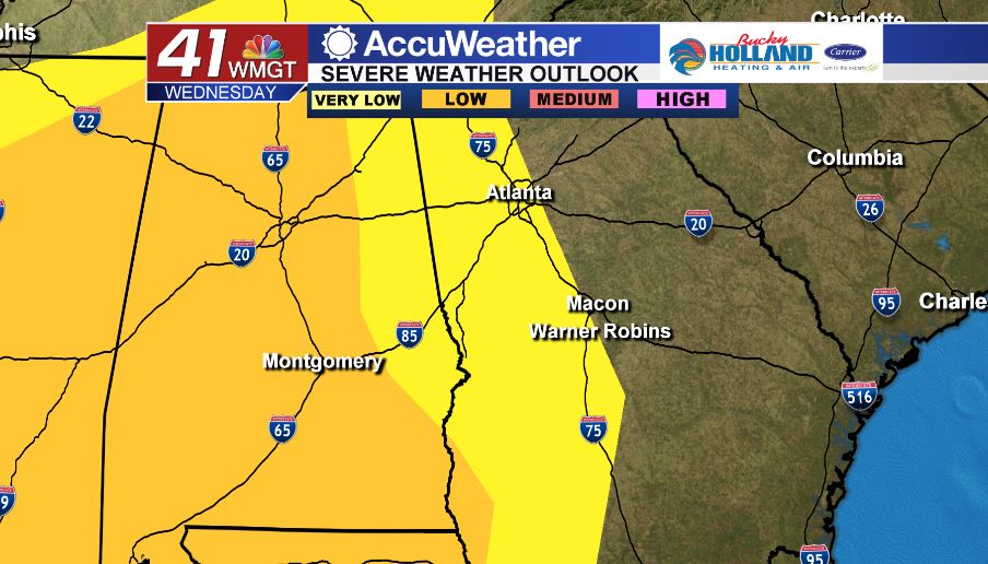
As far as severe weather is concerned for Wednesday the bulk should be to the west of I-75. Main threats will be damaging winds, isolated tornadoes, and heavy rains. Any rain that moves in before 5 pm should be below severe criteria.
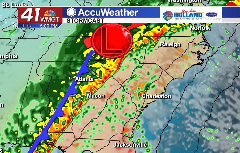
Thursday will bring a better chance of severe storms in Middle Georgia. Although forcing will be a little better in the storms that for out ahead of the line, overnight Wednesday and Thursday AM, better shear (the turning in the atmosphere) will move in along the cold front by Thursday afternoon and evening.
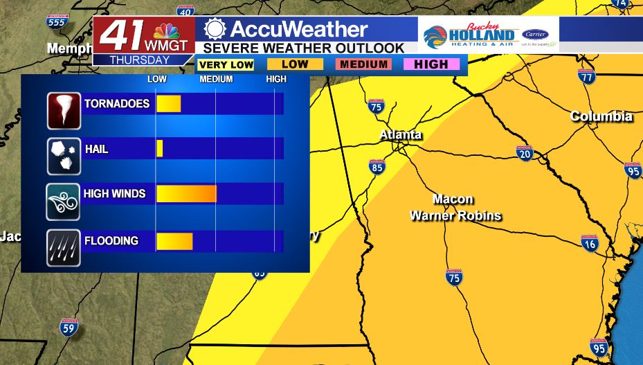
We are keeping a low chance of severe weather in Middle Georgia, but it is still significant, considering the time of year. Once again the threats will be damaging wind gusts, isolated tornadoes, and potential flash flooding.
The threat should be out of Middle Georgia by Thursday night.
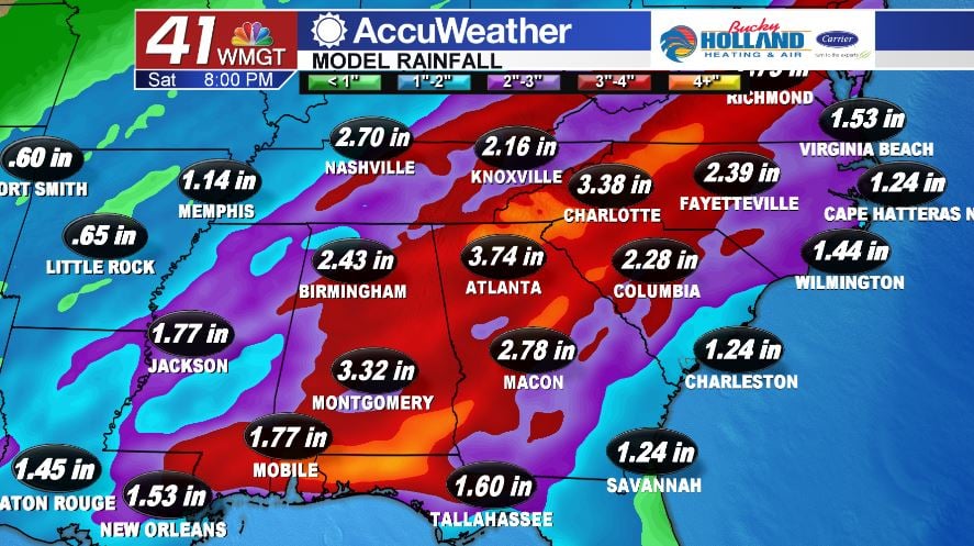
Not only will we see the possibility of severe storms, but also the likelihood of heavy rain across Georgia. Although the heaviest rain will be in North Georgia we are still anticipating 2-3″ of rain here in Middle Georgia.
As usual when we are facing severe weather, we encourage you to stay weather aware Wednesday evening and through the day on Thursday. This means having a plan in place for severe storms and having multiple ways to get your severe weather warnings.


Leave a Reply