


Severe storms possible Saturday
MACON, Georgia. (41NBC/WMGT)- We will stay mostly dry today before strong and potentially severe storms move in tomorrow.
TODAY.
A mix of sun and clouds will combine with temperatures in the low and middle 70’s to make for a pleasant end to the work week. Clouds will continue to build in overnight where temperatures will only fall into the middle 50’s.
TOMORROW.
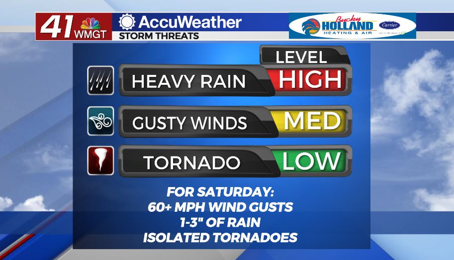
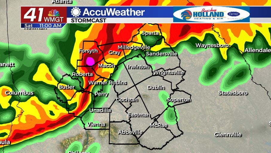
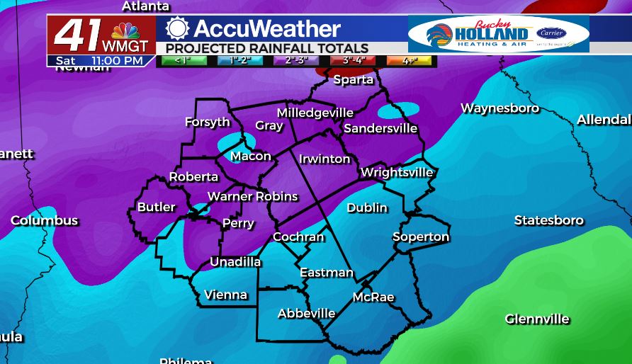
An active weather day will begin early tomorrow morning with showers and storms moving in around daybreak. Damaging wind gusts, locally heavy rainfall, hail, and an isolated tornado will all be storm threats in play.
Round one will begin in the morning and continue through midday. The main threat with this line will be damaging wind gusts greater than 60 mph as well as heavy rain. An isolated spin up tornado is possible, but the better chance for a tornado will come in the afternoon and evening.
Once round one moves through we could see some clearing which will allow our atmosphere to destabilize. If this were to happen, our severe weather threat would go up during the afternoon and evening. That is when an isolated tornado would be more likely.
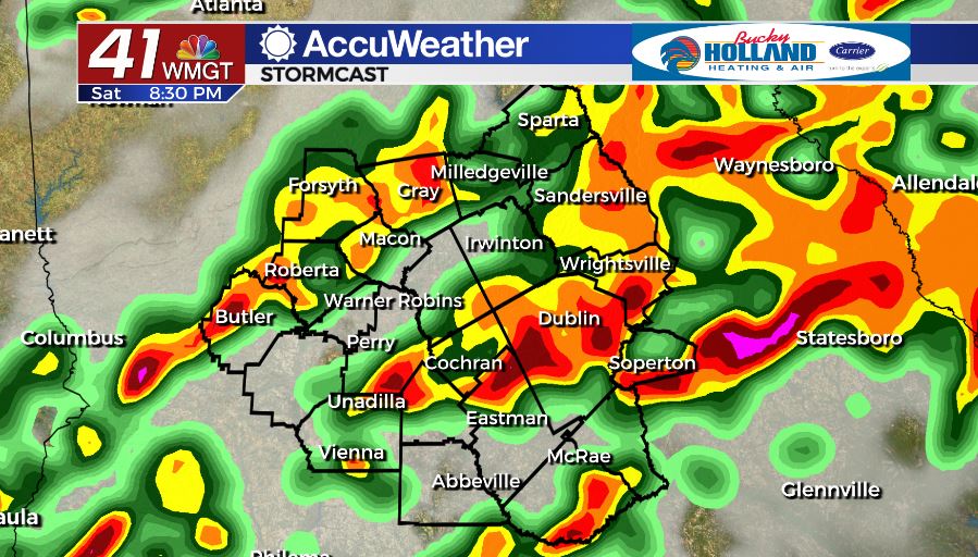
The bottom line is that tomorrow is going to be an active weather day for much of the day. Have multiple ways to get severe weather warnings if they were to be issued.
SUNDAY & BEYOND.
A few showers will linger into Sunday morning, but by the afternoon we will be dry and sunny with temperatures approaching the 80’s. We will stay dry through at least the middle of the week. Temperatures will warm into the middle 80’s.
Follow Meteorologist Dalton Mullinax on Facebook (Dalton Mullinax 41NBC) and Twitter (@MullinaxWX) for weather updates throughout the day. You can also watch his forecasts Monday through Friday on 41NBC News at Daybreak (6-7 a.m.) and 41Today (11 a.m).

Leave a Reply