


Severe storms expected this weekend
MACON, Georgia. (41NBC/WMGT) – Morning showers from a left over frontal boundary will move out and leave behind plenty of sunshine.
TODAY.

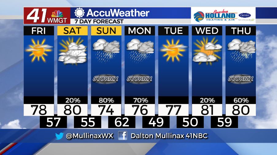
It’s a gorgeous end to the work week with plenty of sunshine in store and temperatures running near average in the upper 70’s. Clouds move in overnight as temperatures fall into the middle and upper 50’s.
WEEKEND.
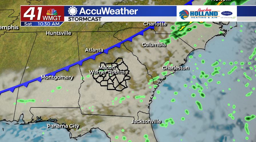
A weak cold front will move through during the first half of the day on Saturday bringing the chance for a few showers. Temperatures tomorrow afternoon will top out near 80°. By Sunday, the potential for severe weather returns to Middle Georgia.
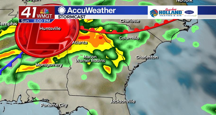
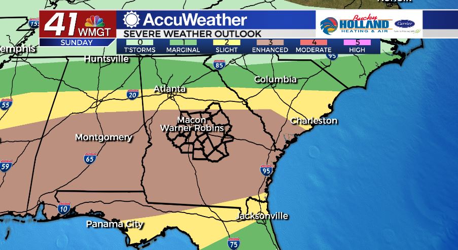
As of 6 am on Friday, April 17, the Storm Prediction Center has nearly all of Middle Georgia in an Enhanced (level 3/5) risk area. A storm system will sweep across the Deep South on Sunday setting us up for another round of strong and severe storms. Right now, storms look to move in during the afternoon and last through early Monday morning. The main storm threats will be damaging wind gusts, tornadoes, and the potential for flash flooding. The forecast will change in the coming days so stay tuned.
NEXT WEEK.
After storms exit Monday morning, we dry out through Wednesday. Right now, models are hinting at another round of severe weather next Thursday. It is WAY too early to get into forecast specifics, but it is that time of year.
Follow Meteorologist Dalton Mullinax on Facebook (Dalton Mullinax 41NBC) and Twitter (@MullinaxWX) for weather updates throughout the day. You can also watch his forecasts Monday through Friday on 41NBC News at Daybreak (6-7 a.m.) and 41Today (11 a.m).

Leave a Reply