Scattered t-storms expected later today as a front pushes south
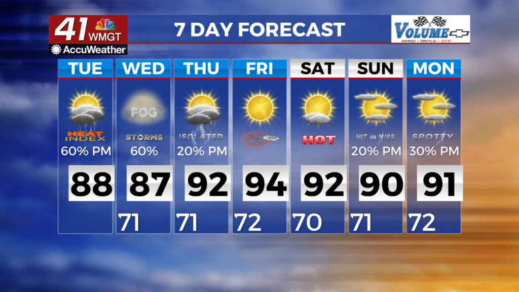
MACON, Georgia (41NBC/WMGT) – For today, we are expecting our pattern of weather to shift with the upper-level trough to swing eastward and dragging a frontal boundary southward across 

 the area into Wednesday. This front will serve as an area of forcing over the area contributing to increased instability. Models suggest a linear formation for these storms as they push across Georgia into the evening and early overnight. The Storm Prediction Center has the area in a Marginal Risk for severe weather and flooding. Storms should limit temperatures to the upper 80s to low 90s however, it still looks to remain hot and humid over the short term. On Wednesday, moisture levels will be near normal across Georgia. As such, seasonally typical weather is anticipated, with afternoon showers and thunderstorms likely. An upper-level trough is forecast to be north of the region, with an area of locally stronger winds associated with it. This could aid in the development of afternoon convection.