


Scattered storms stick around Thursday
Rain has finally returned to the forecast and it looks like it might outstay its welcome through this weekend…
Tomorrow will bring another day of mostly cloudy skies and scattered showers and storms. High humidity that returned today, will be sticking with us through the weekend, ugh.
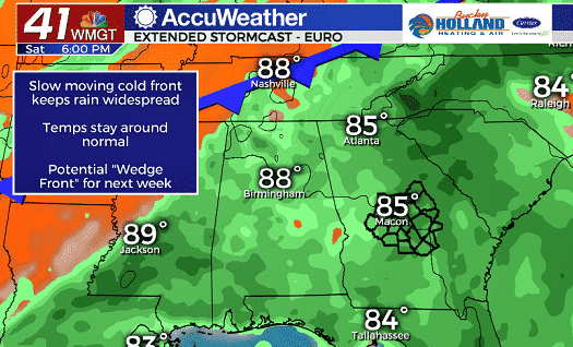
As we head through the weekend a cold front will approach, but generally stall to our north. This means continued rain and storm chances through the weekend until it finally passes through the area next week.
Right now, models are hinting at a wedge front setting up next week. This would keep us cooler than normal starting around Tuesday.
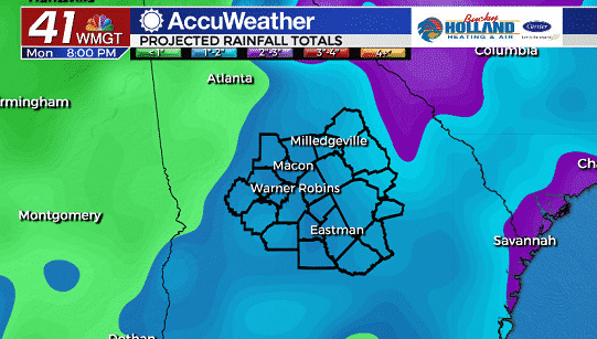
Rain totals through the weekend will be anywhere from 1-3″ across Middle Georgia thanks to tropical downpours.
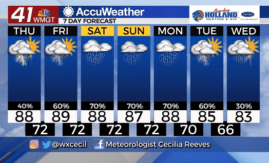
Temperatures through the week and into the weekend won’t be changing much, but by next week (hopefully along with the wedge front) we will see some cooler than normal temps.
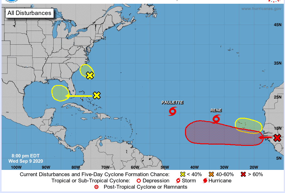
As far as the tropics, we are watching FOUR areas for potential development. Tomorrow is the climatological peak of hurricane season so this isn’t crazy, but this is a particularly active year.
The next name on the list of tropical systems is Sally.
Leave a Reply