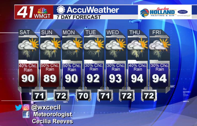
Scattered storms stay in the forecast this weekend
As we head into the weekend, don’t expect much of a pattern change in the southeast. High pressure on either side of us is blocking much in the way of movement for the jet stream. This means we are seeing more energy being funneled into our area, hence, we keep the storms in the forecast.
Temperatures will be much cooler than earlier this week and we are expecting the shower and thunderstorm activity to be scattered, mainly during the afternoon/evening.

We won’t really see much of a huge chance in the big picture, but the stationary boundary that is sitting to our north will likely dissipate by the start of next week. We will also see our high temperatures getting back into the middle 90’s with heat index values in the upper 90’s.

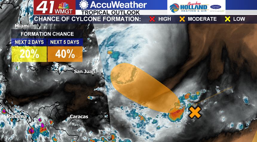
We continue to monitor the tropical wave in the Atlantic. Right now the National Hurricane Center gives this wave a 40% chance to become a tropical cyclone within the next 5 days. It still has to make it through an area of dry air and some shear so we will keep an eye on it as we head into next week.


Leave a Reply