


Scattered storms return tomorrow
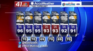
MACON, Georgia. (41NBC/WMGT) – Rain chances will be increasing over the next couple of days as the temperatures return to the low 90’s by the end of the weekend.
TODAY.
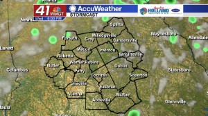
Under a mix of sun and clouds temperatures will get back into the middle 90’s. A few downpours are likely during the afternoon and evening hours as rain chances are running at just about 20%. Overnight we will see temperatures cooling off into the upper 60’s and lower 70’s under a mostly clear sky.
TOMORROW.
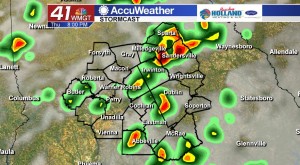
A cold front will begin to stall out across northwest Georgia, but showers and storms ahead of the front will roll into Middle Georgia. Scattered showers and storms during the afternoon hours will be accompanied by temperatures once again in the middle 90’s. We will keep a few showers and storms around through the early night hours, but most of the activity will fall apart after sunset.
EXTENDED FORECAST.
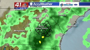
We are going to see the return of our typical “summer-like” weather as we head into the weekend. Afternoon showers and storms will be ongoing each afternoon with the best chance of rain coming on Friday afternoon and evening. The weekend will not be a washout, but scattered showers and storms driven by the heat of the afternoon could alter outdoor plans. Temperatures this weekend will be topping out in the low to middle 90’s in the afternoons and upper 60’s and lower 70’s overnight.
 Follow Meteorologist Dalton Mullinax on Facebook (Dalton Mullinax 41NBC) and Twitter (@MullinaxWX) for weather updates throughout the day. You can also watch his forecasts Monday through Friday on 41NBC News at Daybreak (5-7 a.m.) and 41Today (11 a.m.).

Leave a Reply