Scattered showers & thunderstorms stay around for Tuesday
MACON, Georgia (41NBC/WMGT) – Isolated to scattered showers and thunderstorms continue today through Friday across much of north and Middle Georgia. A cluster of storms moved through 
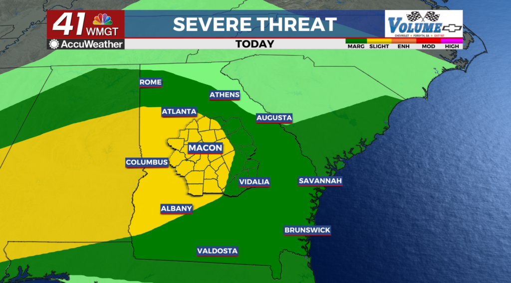
 the early morning hours. These storms could produce strong wind gusts, small hail, heavy rainfall, and frequent lightning. The probability for a tornado is low, but not zero. Cloud cover for the most part has kept the environment fairly stable. How much sun and destabilization occurs in the afternoon will help determine how juicy the atmosphere is once storms arrive (even after daytime heating ends). Another consideration is the wedge boundary across portions of northeast Georgia. This could intensify updrafts along the leading edge of the line. The Storm Prediction Center has the majority of our area in a Marginal Risk (level 1 out of 5) for severe storms through Tuesday morning, with a Slight Risk (level 2 out of 5) along and south of I-20 starting Tuesday morning as the organized band of storms moves through. The Mesoscale Convective System (the large organized band of thunderstorms) assuming that it maintains intensity as it tracks across the Southeast, will bring damaging wind gusts, small hail, heavy rainfall, and frequent cloud to ground lightning.