


Say goodbye to cooler temps and hello warm-up
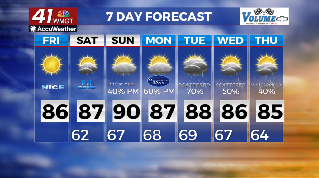
MACON, Georgia (41NBC/WMGT) – A reinforcement of the cooler, drier airmass arrived across North Georgia Friday morning. Widespread 50s are likely Friday morning in North Georgia with 
 highs remaining in the 70s to low 80s, though highs in the upper 80s to near 90 will linger in Middle Georgia. For Saturday, an upper level trough from the east coast and a ridge building over the Central U.S. will be the players for our next weather event. Our region will be under a northwesterly flow. Moisture returns to the area as winds slowly shift to the south, creating instability across Middle Georgia from northwest to southwest both Saturday and Sunday. Two small shortwaves will form within the northwest flow — one on Saturday and one on Sunday. If they hold together, we could see a push of storms into Central Georgia both days. This could be an organized convective line. The unsettled pattern continues for Monday and Tuesday bringing increased rain and storm chances.